VFRDiscussion ARCHIVE / READ-ONLYREAD-ONLY

Tales Of Zumo

106 posts Started 27 Feb 2007 Last recovered post 5 Feb 2011 Wayback Machine snapshot 2 Oct 2023

#1
[image: Posted Image]

It is raining in San Diego and I thought I would pass on some impressions on my new Zumo 550. Santa delivered my first GPS. The same woman who released me from driving her home from Arizona so I could tour AZ, bought me a Zumo without prompting and really no coaching.

So I am going from this -
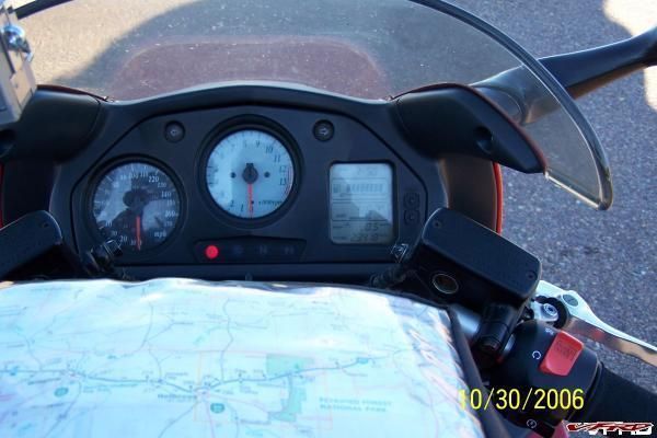
Posted Image

To this –
[image: Posted Image]

While I have used a few GPS units in rental cars over the years my last real experience with a GPS device was on a destroyer in the Indian and Pacific Oceans a few years ago. There were no cameras then so I do not have a picture. My God!!!

Modern GPS units sure beat the hell out of a sextant, but for some occult reason I have not been an early adopter for my cars and motorcycles.

I have been looking at GPS units suitable for bikes for years and I was particularly enthralled with the potential or hype about the Zumo. I even made the journey to Laguna Seca and the Garmin booth last year, along with about two million of my best friends, in part to see the first public unveiling at the GP.

I must have seen these global units on the way to the Garmin booth. Latest display technology! :unsure: :rolleyes:

[image: Posted Image]

Too bad I forgot my dual pane display instruments.
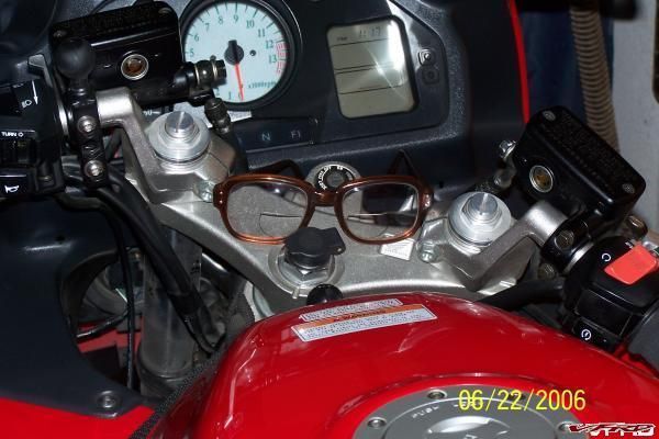
Posted Image

The following key factors pushed me towards the Zumo:

1. I had two significant VFR rides last year (Sierras and AZ) and both times I could have used some navigational aid ie missed turns or had to reroute because of screw-ups.

2. My Verizon Cell GPS during my AZ experience was less than satisfactory.

3. The Zumo is waterproof, the right size and seemed perfect for both the VFR and the Big One.

4. The mounting kit adopted the RAM system, which I have on both bikes, plus it has a mount for my truck.

5. It uses voice directions and has a MP3 player which saves on precious cockpit space.

6. The Zumo is bundled with a trip planning package called Mapsource plus I could also use Streets and Trips, which I have been using for years to map out my adventures.

7. The Zumo has a battery which means I can evaluate routes and make adjustments etc while sitting in a restaurant. I find this very helpful as I often thrash out mid course corrections with my riding buddies during rest stops. With Zumo you can get an almost instant miles/time to go read out to properly consider your options.

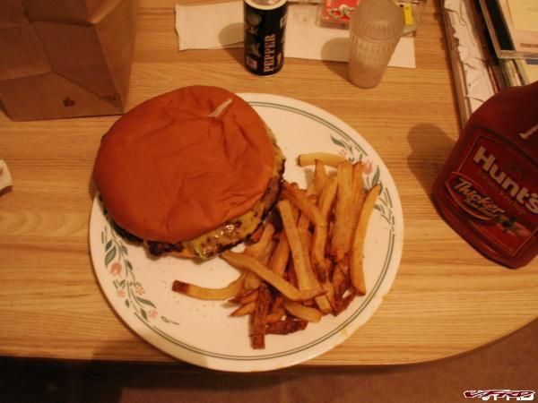
8. And lastly it has the latest SIRF chip, which increases its sensitivity and responsiveness including those times when you are eating a greasy hamburger in a dump with a roof alongside the road in the sticks.

Ten days ago, I rode from San Diego to Borrego Springs to test routing with the Zumo. As I was primarily interested in measuring the Zumo performance, I took the "other" bike as the Zumo was installed into the sound system and I had integrated my Bluetooth phone as well.

[image: Posted Image]

Despite my initial difficulty, I used Mapsource to plan the route and down loaded the route into my Zumo. I had ver 2.5 of the Zumo OS loaded at the time. There have been two software upgrades since my trip. Wow they must really care!

[image: Posted Image]

Next installment Trip observations.
#2

[image: View Post]Bent, on Feb 27 2007, 07:21 PM, said:

Where on the bike did you tap into to get power to the unit? Does the software show the little bitty county roads since I mostly ride in the middle of nowheres twisties? Thanks!

I use the Garmin power hookup that came with the Zumo. It's fused and connects direct to the battery, but I don't have any other electrifarkles. If I did I would go with the Blue Sea fuse box (or something similar) that has been written about recently.

Standard map on the Zumo (CN North America NT v.8) seems very good for road coverage. However, as with all software packages it will not show new roads or recently reconstructed interchanges that have been built in the last two or three years. I have not done any dualsporting with it so I can't comment on FS roads, trails, etc. I have also loaded the eastern US topo map onto an SD card which I use more for work that takes me into remote areas in the Appalachian mountains. It would be good for hiking and similar activities if you are comfortable reading drainage featuers and topographic prominences rather than roads. It seems to have pretty good coverage on less travelled roads, but it is an older software package without support, so it is what it is.

I am very pleased so far. :thumbsup:
#3
Part two

First some miscellaneous ramblings and a brief description of route planning and the software that comes with the Zumo.

The easiest way to load a route is to build it directly with the Zumo. It is pretty simple to figure out but it does take some time. Before you go too far though, I would register your unit and download the latest firmware for the Zumo. Otherwise you may have some problems interfacing with Mapsource (discussed below) down the line. Since Santa delivered, I have upgraded the Zumo software 3 times (2.5, 3.0 and 3.1). These updates included undocumented features (some people call them bugs) and suprisingly number of feature updates. :thumbsup:

The other Garmin way is to build a route using Mapsource. This is confusing right from the beginning as City Navigator NT version 8 (in big print) is included with the Zumo package. Turns out Mapsource is the software interface/tool to (trip and waypoint management) organize/control the latest maps which are found in the City Navigator DVD.

Fortunately, Mapsource is also included on the DVD disk but you have to read the small print to find it is there. As stated above, you do not need to load Mapsource onto your PC to use the Zumo. And for Pete sakes DO NOT throw away the yellow sheet with the Unlock code for Mapsource that comes in the box.

Note DVD not CD that was my second problem. My old computer has a CD but not a DVD. Fortunately, I figured this out on my own before Garmin Tech support told me I was an idiot.

But before you download waypoints/routes to the Zumo you need to update the Mapsource product too.

Once you are ready to get your route to the Zumo, there is a menu button on the Mapsource tool bar to send routes/waypoints to the device (Zumo). Right in the middle of the tool bar below you can also see a similiar button so you can download logs so you review your trips on Mapsource when you get back.

[image: Posted Image]

This is one of the views of what it looks like when you load the route into the Zumo. Note the flags on the screen which are waypoints, which in this case forced my route to 94 which runs parallel to Interstate 8.

[image: Posted Image]

But there is no need to download maps to the Zumo, as City Navigator v8 is already loaded onto the Zumo. Do not load more maps onto the Zumo as you will fill up the drive. Perhaps you will load topo maps in the future but you do not need to do it right away.

Mapsource is not a friendly as Streets and Trips but I do not want to whine tooooo much till I give it a chance.

This brings me to the third way to load routes into the Zumo ie using third party software say, for example, Microsoft’s Street and Trips. This is not discussed in the Zumo manuals (latest one online the one shipped is already obsolete) but is described, you guessed it, on the Internet. This is how you do it.

Build your route in Street and Trips using no more than 10 waypoints.

Import your Street and Trips file into the this shareware program
GPS Utility and save the file as a GPX extension. You can handle more the 10 waypoints but you have to pay for it.

Copy the GPX file into the Garmin/GPX directory on either the Zumo or the SD card. Remember to “Safely Remove Hardware” first before disconnecting your USB Zumo.

When the Zumo prompts you just import the route into the unit.

One final route on building routes. Before you are done make sure it looks the same after it uploads into your Zumo. Some of the settings in the Zumo may change your route when you upload it. For example you may have fastest driving time set as your default in your Zumo and your route may be on a backroad, which may drive the uploaded route to change.

The solution is to look at it after it is uploaded and if you need to add waypoints to force the route on certain roads. Pretty simple really once you have screwed it up a few times. I had to do the same thing all the time when I was planning routes on Streets and Trips even before I had a GPS.

Sorry about the above but I had to learn all of this the hard way.
<_<
#4
Part Three

Another shot of the Ram Mount with the medium ram bar.

[image: Posted Image]

On the Wing, I have two RAM balls on the left grip, so I can add another accessory ie a camera in this case. I may do this on the VFR too. Of course you can always add another ball to the right grip but operating the equipment would be a pain - unless you have cruise.
[image: Posted Image]

You can just see the Ram Mount Ball attached to the forward bolts on the tank. Many of you have done this modification on your VFRs and this turns out to be great place to mount the Zumo.

Posted Image

Here is the Zumo on the tank ram ball again with a medium ram bar. The medium extender is needed again to clear the tank bag and also to allow access to the Powerlet socket in the stem. The screen of the Zumo shows one of the new views available with release 3.0/3.1. Compass and altitude along with GPS accuracy are there to see. None of the VFR instruments are blocked with this rig.

[image: Posted Image]

To be frank there is not a lot of difference in left hand movement required from the grip to the handlebar mount or the tank mounted Zumo. You can see from these photos that it would be easy to access with the left hand. Most of the time I use the touch screen but I do use the hard buttons on the left. For sound I either plug the Zumo right into my Goldwing sound system via a 3.5 jack or just plug some ipod type earplugs/speakers or my IMC helmet speakers direct into the Zumo when I am on the VFR. You are good to go as long as your earbuds/speakers have a 3.5mm plug.
[image: Posted Image]

Some folks do not realize that there are in effect two volume settings. One is the basically a balance between the relative vol of the navigation and MP3, this is controlled from the tool menu. The stock setting give a slight bias to the vol of the navigation prompts. The major volume control is the third hard button on the left.

Next on the road with the Zumo
#5
I forgot to mention that probably the best source on the web for Zumo info is:

Zumo Only URL
#6
Part Four - Now about my field trip to Borrego with the Zumo.

I met up with some buddies to escort me East from San Diego. As we never plan where our breakfast stop till the gas is in the tank, I did not have our feeding hole cranked into the Zumo. As soon as we veered off route the route to Borrego towards breakfast, Mr Zumo starting recalculating and trying to get me back on track.

This may get tiresome especially when you following somebody else and not following backseat driving orders from the Zumo. Perhaps you have experienced this from your SO. Of course, I have not but I have heard about the phenomena. But fortunately, you can do something about the Zumo case, if not the latter.

Regardless if you want the shut the lady off, just touch the MENU screen (bottom center of screen and then hit STOP. You stop following the route but you still know where you are.

See … I am on a small side road close to the freeway here.
[image: Posted Image]

Normally, the Zumo screen looks like this when a route or destination is loaded. This is the basic navigation screen and the key for me is the next "Turn In" on the bottom right corner of the Zumo. This tells you far to go before the next turn and provides automatic voice prompts as well.
[image: Posted Image]

Please note that I was not speeding in these shots!

If you miss the voice prompts along the way you just have to touch that “Turn In” on the screen and the Zumo gives you an updated voice prompt and the distance to turn. This prompt includes the name of the street you are looking for. This is fantastic and this is what I needed most on my recent VFR rides in the Sierras and AZ. :thumbsup:

If you want to review all your turns just touch the bar on top of the screen in this case “Left on Lyons Valley Rd”

Here are the usual suspects after Breakfast. Normally there is another 5th Gen VFR with us. That is as far as they went this trip. Instead of my VFR, I have been riding my Wing a lot this season. Not sure why - maybe because it was the coldest Jan in 40 years in San Diego and the electric grips on the Wing.

[image: Posted Image]

[image: Posted Image]

I found my other 5th Gen buddy “riding at Laguna”. Did I mention the racing was great?
[image: Posted Image]

Notwithstanding yet another Indian Gaming casino stop in San Diego for breakfast and despite the “French Pancakes”, I was able to reload my route to Borrego. Takes about 15 seconds.

When I restarted my route, the Zumo picked up my next waypoint/via point (still not sure what it is called) and prompted me correctly along my preferred route to the desert and on to Borrego.

More on the road next
#7

[image: View Post]theoxmole, on Feb 28 2007, 10:57 PM, said:

[image: View Post]BonusVFR, on Feb 28 2007, 05:41 PM, said:


...................................Obviously this thing isn't as great as I originally thought. . . it clearly shows you riding a 6th gen (note the dual, underseat exhaust). :lol:

[image: Posted Image]

This one is just worth posting again. I'd follow their directions any day! :thumbsup:

Now on a serious note, my Garmin C330 screen looks the same and it sounds like it functions the same. How are you getting the voice prompts into your helmet?


I am hoping the new RED icon is better and does not have the extra weight of the second exhaust :thumbsup:

OK - Here he is again???????????
[image: Posted Image]

The voice prompts and the MP3/etc come out of the MC mount female plug. Here is a picture of a standard type earbud plugged into the 3.5 jack. My IMC headset also works with this jack. On the Wing I just plug my Aux input male 3.5mm plug into the same place.

Once you do it once you never forget! Right! :thumbsup:

The covered jack above the 3.5 is for a 2.5mm plug typical of headsets for cell phones etc.

[image: Posted Image]

The Zumo itself actually has no sound output. Only the MC and car mounts have sound output jacks.
#8
On the Road - Part Five

Some of the biggest complaints about the Zumo from the GPS Nazis (that is what I call them) are that you can not see your actual track (not route - but where you have been) on the screen and there is no altitude reading. Both of these complaints were addressed by the latest software upgrade ie 3.X.

Most of the criticism has come from people who do not own one. Kind of like VTEC, I guess. The number one complaint by far is “the Zumo” keeps trying to get you to your final destination” by recalculating the route when you stray far from the designated route. I will talk about this more with my wrap up.

Anyway here is one of the upgrades, the altitude screen, which you can easily see by using the page hard button on left side of the Zumo. It is the third one. Or you can just hit the motorcycle icon on the main screen which gives you position and altitude. You can also save your current position as well if you want it for recall later. This is great if you want to mark a location you want to visit again.

BTW Garmin now has a Red Motorcycle icon which I will upload in the future.

[image: Posted Image]

Now to the track issue. After my overnight in Borrego, I returned the next day. Subsequently, I loaded ver 3.0 of the OS. One of the items touted with the update is “Added option to display track log on map”. I was able to DISPLAY THE TRACK LOG ON MAP despite that I have been using ver 2.5 on the Borrego trip. You can now see the track log displayed while you are navigating.

Here is the track of my breakfast stop North of Interstate 8 at a new Indian Gaming Casino. If you zoom in on the Zumo you can see the tiny road to the Casino as well.
[image: Posted Image]

It is easy to activate the feature in the tools menu.
[image: Posted Image]

This is how you "show" the trip log and make it visible on the map.
[image: Posted Image]

You can now see the track log displayed while you are navigating. I guess this means that ‘breadcrumbs” are finally here and you can retrace a route if needed by following the track? This is the track from the entire trip.
[image: Posted Image]

To the East you can see some of the track is not shown. I experienced Black Death on my Zumo (ver 2.5 loaded then) for about 30 miles till I figured out how to reset in Agua Caliente. Black Death is when the screen goes eh….black. This was the first and only time my Zumo has crapped out.

I am certainly no expert but I attribute this loss of the track data due to the intense vibration I experienced while passing these Fill in the Blank just North of Octotillo. :blink:

[image: Posted Image]

This is where I reset the Zumo. Resetting is simple if you know how to do it but the instructions were in my trunk under some camping junk. The Agua Caliente Springs campground is on a poorly maintained loop south of the store where I stopped. I headed North once I left the store. By the way this is a good look at the level of the road detail available on the Zumo.
[image: Posted Image]

Next Borrego or Bust :wheel:
#9

[image: View Post]tok tokkie, on Mar 1 2007, 09:02 AM, said:

Thanks very much for the description of how Garmin has addressed the complaints. I noted your description of the complainants being similar to vtec critics.
What does the Zumo do if you go into the blank areas between the known roads? (I accept you won't be doing that with the Wing).

Is Cape Town somewhere up there by Santa Barbara. God you have to love the Internet!

I think Garmin has done a remarkable job of putting out changes to the Zumo. 3 changes since my wife delivered it in a sled, which is tough going BTW in San Diego. Having worked at two software companies, I know what a challege it is to update software. I am impressed.

Now to your question..........

Here is an example of the sum total of my dirt experience, since I crashed hard on my 250 motocross bike way back in the day.
[image: Posted Image]

So take everything I say with a grain of salt I mean dirt.

I think the Garmin engineers/marketers were talking to mostly street riders when they crafted the Zumo specs. Much bigger market and they seemed to have hit the basics pretty well. But the Zumo does have off road capabilities.

First there are dirt roads on the Zumo maps but several have been loading Topo maps onto their Zumo for better dirt road info. I have to say the best guys on hard core GPS dirt capabilities are found on the GPS thread on advrider.com . Some of those would use less than complimentary terms to describe the Zumo's off road capabilities. Somehow, my VFR would get the same rap on the dirt! Never mind my Wing. What a surprise!

Near my house there is a road, Proctor Valley, which turns to dirt for miles just north of the lake. You can see how it looks but I could have given you more detail.
[image: Posted Image]

When you go to the Off Road mode on the Zumo you get a screen like this. Here I am navigating through my neighborhood direct to a point. I imagine I was on a plain with elephants or tigers or something. Do you have those things in Santa Barbara. Keep in mind that I am in my office now on the 2nd floor with a heavy tile roof. But you asked. And another thing none of the so called dirt GPS machines could get a fix like this except maybe the 60x version which has the Sirf chip too.

Here I am headed off road to Point 004.
[image: Posted Image]

You touch the arrow on the bottom right and you see this. This tells me – boy you have to go left a little to get to you destination in about 3 miles. The off road screen has a direction arrow unlike the regular compass screen.
[image: Posted Image]

Does this diatribe help?
#10

[image: View Post]BonusVFR, on Mar 1 2007, 06:54 PM, said:

Is Cape Town somewhere up there by Santa Barbara. God you have to love the Internet!

Judging by this, geography taught in US schools is somewhat euh lacking? :goofy:

(Hint: most of the current american citizens descent from people that originated from some other place on the globe, hence the names of your towns originate from somewhere else. Be gratefull, because the native american (can I say Indian?) "this is where the eagle soars high in the sky" is a pretty long name for a town...)
:offtopic:

to stay -somewhat- on topic, this is what I use for GPS on the bike:
iPAQ pocketPC in rugged case
[image: Posted Image]
I slide it in the tankbag and only fire her up (TOMTOM software) if I'm lost or need to find a petrol station/restaurant.
Thing is, I ride my motorcycle whereever the wind takes me, wanting to get lost (but having some way of making it back..)
#11
Wrap up – Part Seven

I forgot to mention to find my way home from Borrego, I just touched “Go Home”. ET never had it so easy.
[image: Posted Image]

But you could just as easily return to a "Favorites" or "Recently Found" location. This would be handy on a trip and you wanted to return to a motel or campground.

Lesson Learned:
1. Whether you are downloading routes from Street and Trips or Mapsource, always review the route after it has been processed by your Zumo. You may have to modify the route by adding more waypoints in the source PC program. Alternatively, you can modify routes on the Zumo by adding/removing points to include your destination or end point.

Also check your Navigation preferences in the Zumo Tools Menu to ensure your route generation is in accordance with your real wishes ie faster versus shortest, vehicle type, avoidances (U turn, Highway, Toll, Trafffic, unpaved roads etc).

2. Of course, the Zumo is not fool proof. So for Gosh sake never utter these fateful words- “Maps, I don’t need no stinking maps.”

3. I have found that sometimes when you add a waypoint such as a town, Mapsource/Street and Trips may drive you off the actual route to find the geographic center of the town. This may in fact be off the main highway no matter how small the village/hamlet is. As I result I find I am using actual streets or intersections often to drive the route to avoid algorithm driven detours.

4. Keep your eyes out of the cockpit and on the road – Zumo is great but watch where you are going. The aural alerts do most of the work so don’t focus on the screen!

5. Despite the complaints from many of the GPS purists in this, I find the recalc issue a red herring. Again “the Zumo” keeps trying to get you to your final destination” by recalculating the route when you stray far from the designated route. I just touch "stop" on my Zumo when I screw around and purposely go off route. Then I just reload the route and it directs me to my next waypoint. Never lost a route yet.

6. I find since my overnights are often loops that I make one route for the two days. With the Zumo that works but is not optimum way to program the machine. My rule of thumb is one day-one route. That way you will always have the Zumo cue you to how far and what time your day will end. In other words load a separate route for each day on the road.

This way the "Arrival" time is accurate for where you are going that evening. Add it is remarkably accurate too!
[image: Posted Image]

This screen gives you the whole route and miles to as well as time.
[image: Posted Image]

You may want to go to Borrego because of my lame post but beware. The California Department of Transportation (Caltrans) will close a portion of 78 near Scissors Crossing and in the vicinity of the San Felipe Creek Bridge (about 12 miles east of Julian).
http://www.dot.ca.go...07-78Bridge.doc

The plan calls for closing the highway in both directions at that location from Monday, March 12 through mid-afternoon on Friday, March 23. THIS means all the RVs, Trucks will going down and up Montezuma grade in that period. Watch the center line and slow down!

Interestingly enough this is prime Vintage Motorcycle and flower viewing. Be safe.

A few photos from previous years. I think this is an Indian (European name or "Eagle soars high in the sky").
[image: Posted Image]

Looking down into Borrego with flowers
[image: Posted Image]

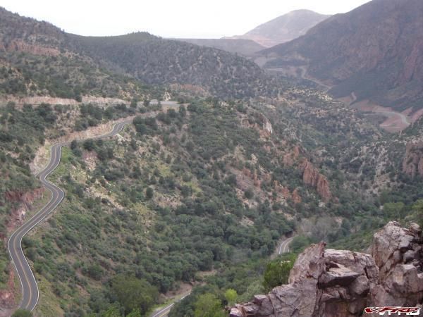
Montezuma Grade with switchbacks galore.
[image: Posted Image]

Thank you and in summary the Zumo works for me. I hope you found this overview helpful. :goofy:

Next stop “Run the Ridges” of our Green Land Tennessee? :goofy: At least on my Zumo MP3 – what a route! Did I mention the MP3 player? :thumbsup:
[image: Posted Image]
#12

Nice write-up man, you're really making me want a Zumo. I have a question for you. I'm not advocating talking on a phone while riding, but, you actualdo have that capability with this thing right? As long as you have a bluetooth phone and a headset that I guess would plug into the Zumo. Like I said, I'm not promoting cell phone use while riding but I think that can be really convenient to just be able to pull over real quick and use the phone without having to dig it out of your bags. Is there a cell phone interface where you can dial from the Zumo?


I am not a cell phone guy. But, I had an epiphany about 6 weeks ago about this whole cell phone issue. My cell moment came when I was the first on a scene when a R6 rider hit a tree. Taking off all your gear to check to see if you have a cell does not save time and maybe could have cost more. Eventually when more assistance arrived, I had to ride to where I thought I had a cell. Fortunately I did (after I took off my gear again) and I still made the first 911 call. He will be ok (after months of therapy and a helicopter ride out of the hills).

There are lots of different ways to rig the phone up to the Zumo. For both bikes I will activate the Bluetooth on my phone. You can put your phone anywhere: jacket, bike pocket, tankbag as there are no wires involved. Lots of neat things happen immediately when the phone links to the Zumo via bluetooth. I really did not have to configure anything it just happens.

First you find out/see even if you have a cell which is nice especially if you run in the mountains often. Secondly you see/hear when somebody calls and have the option to accept or.........You also have your complete phone address book on the zumo. You dial direct from the Zumo using the touch screen, it also has a neat feature to call home (that ET thing again). There are more things available: missed calls and all the rest but those are the highlights.

On the VFR I do not have immediate plans to talk thru the zumo/phone (need a hard wire or Bluetooth mic for that). I will however know already if I have a cell before I pull over and will also know if somebody important called before I do so.

On the Wing, I can talk now through my regular headset mike which is hardwired into my stock sound system and the Zumo. The Razor bike forum has a bluetooth section as well. There are just too many options here: bluetooth helmet, autocom, starcom, bluetooth only, phone or mp3 or nav or all, etc etc etc to give you good advice without the particulars.

http://razorbiker.co...ewforum.php?f=4

I think I read on a forum that some guys are using it for bike to bike thru their Zumos. I think I will stick to FRS/GMRS for the moment as cells are not realiable in the MTs/remote areas.
#13

just curious. now that you've figured some of the ins and outs of the unit, do you find it useful? i've never found it difficult to navigate with a map, and generally rely on word of mouth or strangers for details on good roads.

seems like it provides a lot of useful information about trip, distances, etc. but requires a lot of input from the user, especially when riding.

thanx for sharing.


I do find the Zumo very useful especially on trips to unfamiliar terrain. :thumbsup: Maps are still almost a necessity I fear. You need the big picture and the map format is comfortable to most. But this is what maps can not do.

Tell exactly when the next turn is coming up which prompts you to look for it. This takes no interaction it is on the main screen.
[image: Posted Image]

And I really like the screen which tells you how far to your final destination for the day. No questions - the answer is right there with just a few touches.
[image: Posted Image]

I need the help. For example, you pull out of small town enroute to a turnoff miles away. All of sudden you get distracted by traffic or pray tell the view and you fail to note the exact mileage to your next turn. Maybe you failed on your last stop to note precisely when the next turn is - you just know it is up the road a bit. I used to mark each turn with the route number and the mileage to it on my windshield but that is a lot of work. And if you failed to note your trip odometer this technique fails.

All it takes is one truck blocking your view and you can miss the turn/route sign. Maybe the marker is under a tree in the shade and you missed it trying to get the perfect line. Or maybe you were picking your way through a pack of cages and were just too focused or forgot to look around for signs.

Unfortunately, I have missed several turns especially in the backcountry. With the Zumo the distance to turn and arrival time is always there so you are prompted to look for the turn. Plus the beatiful lady is telling you heads up idiot!

You can and will still get input from the locals but now you can figure out exactly the mileage to determine the feasibility of a detour. How often have you heard - oh it is just up the road a bit - don't exactly know how far and be careful because the road is not marked well. <_<
#15

Have you GPS guys checked this site out?
http://www.sundaymorningrides.com/

Seems like a pretty cool way to get and share ride routes.


Will take me a while to figure it all out.

Most of the trip maps, I have downloaded, have been in Streets and Trips format. That way you can play with it to suit your requirements.

One thing for sure if someone sends me a ride I will want to look at it first on Streets and Trips or Mapsource. Then I will import to the Zumo. The PC programs are just better suited to planning I think for a whole bunch of reasons: screen size, keyboard and performance.

I can see bringing a debugged route to share with a fellow Zumo rider on a trip though. It would be nice to be talking/listening from the same script just once. But you would still have the unannounced detours to see something or other. :thumbsup:
#16
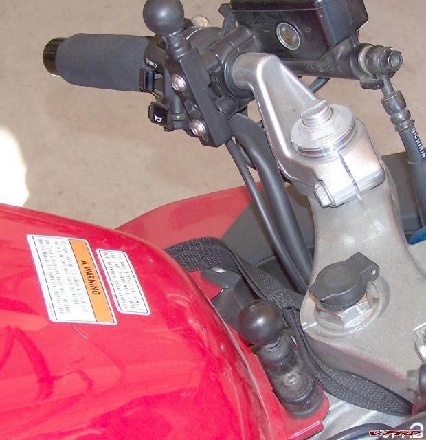
I have had a few questions about the RAM mount at the forward edge of tank.

Here is a picture of both RAM mounts, the RAM handlebar mount packaged with the ZUMO and the RAM ball forward of the tank.

Posted Image

With regard to the RAM mount forward of the tank, I used RAM-B-231Z part # and installed it without using the Zinc U bolt. This install has often been discussed on VFRD. Thanks again VFRD.

RAM 231 link - Any RAM dealer will have this part.
http://65.102.174.11...mber=RAM-B-231Z[/url]

I fitted the RAM mount over the existing tank flange, which secures the leading edge of the tank. I purchased slightly longer bolts than the stock ones to secure the RAM mount over the flange.

The RAM ball Installed forward of the tank
[image: Posted Image]
#17
Wiring a switched auxiliary fuse block.

I finally got around to the permanent setup as regards wiring the Zumo. As mentioned previously, I prefer not to wire appliances directly to the battery. I want my accessories to be switched. The basic reason is that I have a severe case of CRS, which ultimately leads to inter alia battery failure.

For the VFR, my solution is another Garmin Power cord running to an auxiliary fuse block hooked to a relay triggered by my license plate light. But the first thing has to be the fuse block install.

I choose the 6 pole Blue Sea Fuse terminal. They have been several “how to” posts on VFRD about this particular fuse block. Besides the Bluesea rig, I looked at aftermarket blocks from Electrical connection, Aerostich/Centech and your basic box sold by NAPA etc.

I finally opted for the Bluesea because of its size, ruggedness, obvious marine/water suitability, an integrated negative bus and that both ATO or ATC blade fuses are acceptable.

http://bluesea.com/c...1/products/5025

First, I mounted auxiliary fuse block from Bluesea. Note that I have both ATO and ATC fuses installed.
[image: Posted Image]

Note I do not have any devices hooked into the fuse box here except my powerlet plug input which has its own fuse already and you can not really see here.

The basic wiring instructions came from a website I was referred to. This is the best resource I have found to wire a relay and fuse box so that your accessories are switched.
http://www.canyoncha...neric/relay.php

A picture is worth a thousand words particularly mine so here is the critical wiring diagram.
http://www.canyoncha...agram-final.jpg

To collect the miscellaneous 14 & 18 gauge wire and connectors, I shopped at Aerostich and auto parts stores but later I found out you can get everything you need at Walmart and less expensively too.

The wiring diagram calls for a 4 pole Relay but Aerostich sent me a 5 pole. Their tech support said don’t sweat it and ignore the center pole 87A. Pray tell what the other pole does. Probably another manual switch function or something.
http://www.aerostich...ay-p-18316.html

This relay is pretty small which allowed it to fit nicely on the right side of the bike tucked underneath the sub frame. There was a handy plastic tab sticking out from the VFR pan so I just bolted the relay to that.

[image: Posted Image]

Warning don't be alarmed - I have not cleaned up the wiring with tie downs etc.

Thanks again to VFRD, I was able to find the wiring diagram for my 5th Gen. To get the switched “Low Current 12 Volts input from device”, I choose the license plate light. I used a T-Connector to tie into the Brown 12V input wire and attached that to a wire to run back to pole/pin 85.

[image: Posted Image]

This may date me a bit but if you run moon shine at night you could just as easily plug right into the hot lead (brown wire) for the license plate light. The relay would work and your plate would be dark and Robert Mitchum would be proud.

Thunder Road
[image: Posted Image]

Next step is to wire the Garmin Power Plug but that is a piece of cake now that the hard part is done.
#18
Came accross a very robust, low cost navigation tool for the globe-trotting motorcyclist.
From now on you will have the entire world at your command!
Mounts on the forward controls, RAM mount is optional.


[image: Posted Image]

:P
#19

Wow, this gizmo is really cool. I got the TomTom rider a year ago and love it, but it doesn't have the trip log / bread crumb feature that most GPS units have and that would be cool to have a record of all the places you've been.


Earlier I showed the track as it is shown on the Zumo. This is how the Zumo depicts your actual track (not planned route) as I left Agua Caliente on a back country road towards Borrego. As I said before you can leave this track on the Zumo if you like – maybe you are retracing your route for instance.

[image: Posted Image]

Below is an example of what it looks like when you download the tracks (actually where you rode) from a trip to your PC. They load right into Mapsource and you can really dissect each trip.

Here is the first leg of my return trip from Borrego to San Diego. The track record includes 46 points of information for the 2.6 miles from my camp site to the gas station in Borrego, which was my first stop.

[image: Posted Image]

About 8 different pieces of info are collected for each point i.e. altitude, direction, coordinates, time, speed, etc. You could play with this for a long time to include making altitude profiles, avg speeds for legs and the list goes on.
In the first picture the color of the unused roads is not very distinct from the background:
1. Is it possible to select other color combinations?
2. Have you found it difficult to see under any cirumstances?
#20

Came accross a very robust, low cost navigation tool for the globe-trotting motorcyclist.
From now on you will have the entire world at your command!
Mounts on the forward controls, RAM mount is optional.

[image: Posted Image]

:P


I could have used this Nav aid on my last trip looks like it is easy to fold the page so to speak. You have to rig an internal light for night use of course.

Seems like, I have always been in a rut and stuck with the Mercator projection format.
Posted Image

But now with the Zumo, I just feel like you could substitute the word “Maps” in this famous clip and pretty much say it all. Bogie would be proud in the Sierra Madre.

http://www.moviediva...ages/badges.wav :thumbsup: http://www.vfrdiscus...tyle_emoticons/default/+1.gif :beer:
#21

Wow, this gizmo is really cool. I got the TomTom rider a year ago and love it, but it doesn't have the trip log / bread crumb feature that most GPS units have and that would be cool to have a record of all the places you've been.


Earlier I showed the track as it is shown on the Zumo. This is how the Zumo depicts your actual track (not planned route) as I left Agua Caliente on a back country road towards Borrego. As I said before you can leave this track on the Zumo if you like – maybe you are retracing your route for instance.

[image: Posted Image]

Below is an example of what it looks like when you download the tracks (actually where you rode) from a trip to your PC. They load right into Mapsource and you can really dissect each trip.

Here is the first leg of my return trip from Borrego to San Diego. The track record includes 46 points of information for the 2.6 miles from my camp site to the gas station in Borrego, which was my first stop.

[image: Posted Image]

About 8 different pieces of info are collected for each point i.e. altitude, direction, coordinates, time, speed, etc. You could play with this for a long time to include making altitude profiles, avg speeds for legs and the list goes on.
In the first picture the color of the unused roads is not very distinct from the background:
1. Is it possible to select other color combinations?
2. Have you found it difficult to see under any cirumstances?

As far I can figure out there are no other possible color combinations. Although the colors chg at night. Not sure there is a way to upload different color combos from Mapsource but am not keen to do that just yet. You know the law of unintended consequences!

Color Mode on this screenshot just switches from Day/Night or Auto mode. Brightness obviously makes things clearer and may help with the contrast to make the colors jump out a little more.

[image: Posted Image]

You can also change the level of detail of the maps but this does not change the colors other than to hide some roads/names that would otherwise appear. Most of the screen shots of the Zumo in this post were taken with screen at the stock brightness settings and with the level of detail set at Normal. Normal detail is the middle setting.

[image: Posted Image]

I find the screen adequate as regards my ability to see it. But in direct sunlight it does wash out a bit. As I said before, this was with the factory brightness settings. Subsequently, I have upped the brightness level.

My slip-on sunglass may be factor too as the polarized lenses sometimes makes it seem as there is a sheen on the road and may appear to screw up my Zumo a touch too. I am looking at upgrading my sun glass technology.

The bottom line is that the screen size and clarity work for me. I believe it is one of the best touch screens available. Some would argue that the Garmin marine unit (ie 276/376/378/478) screens without the touch capability are superior.

Here is a screen comparison with a Winger favorite the iWay 500 (see Jon, a GPS aficionado, at goldwinggadgets.com), also a touch screen. Pretty close although the iWay is probably just too big for the VFR.
[image: Posted Image]
[image: Posted Image]
#22
Let me know when this thing comes down closer to $299.
Looks like a fun toy, but that's all it would probably be to me. :D
#23

Let me know when this thing comes down closer to $299.
Looks like a fun toy, but that's all it would probably be to me. :D


Exactly just like my VFR. :wacko:

The biggest return will be on my multi day trips in unfamiliar terrain. Took 3 long trips on the VFR last year and this works.

Now think of the trip reports that this thing can generate.

For instance here is is my log out of Borrego on Mapsource. Ok but just OK

[image: Posted Image]

But when you auto load it into Mapsource and then Google Earth you get this -
[image: Posted Image]
[image: Posted Image]

Now mind you it was probably before the recent rains when they shot this Satellite photo and the campground was a little greener and packed but you can really see where I was. I will not have to steal any more of Sebspeeds pictures for my trip reports.
#24
Nice feature of Google Earth is that you can replay the track log. Load the track in GE, go to options->touring and set camera tilt angle to 70deg & camera range to 3000 feet & speed about 100. Now select the track path and press the play button. You'll get a birds-eye view of your trip.
Here you can donwload a 3MiB rough video sample of how this looks like in GE: http://www.sendbigfi...hp?id=AD4D07A91
With wingdb you can convert a mapsource route to a track to get a preview in GE, it's more accurate than a track-log. OK, this may not be very usefull, but it's kinda nice though :D

Now think of the trip reports that this thing can generate.
For instance here is is my log out of Borrego on Mapsource. Ok but just OK


The tracklog is also usefull for when you want the location of where you took a particular photo during your trip. With software like gpscorrelate you can add the coordinates to the exif data of your digital pictures. The exif data of a digital camera has the date and time the picture was taken, gpscorrelate (or similar program) compares that to the data of the tracklog and adds the location to the exif data of the photo. Other software can extract this data from the photo and use e.g. Google Earth to pinpoint the location. Just make sure the time and date settings of your camera matches that of your gps (there are even cameras with builtin gps).

edit: new link for GE video sample.
#25
I will be playing with GE more. Thanks Rosso. :thumbsup:

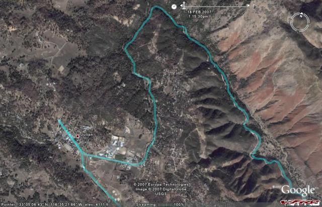
The track log on Google Earth using the auto export feature of Zumo/Mapsource is a fantastic way to document your trip. It is not perfect as there are errors in GPS, which occasionally locate you off the road. Incidentally tree cover does not seem to bother Zumo reception like many of the older GPS units. There is no break in the track despite this road literally being in the trees quite a bit.

This is Banner Grade coming from the East to Julian, CA. By the way if you have not figured it out by the picture below, Banner is an incredible MC road. :rolleyes: If you blow this up or look closely you can see that had some bad corners (rhythm as the other Rossi fellow would say) and went over the cliff a few times.

Posted Image

Edited to add - the jagged nature of the track is more evident in the corners as only a limited number of points are recorded so the track is drawn to connect the "dots". In this leg there were some recorded 670 points in about 55 miles.
#26

Now mind you it was probably before the recent rains when they shot this Satellite photo and the campground was a little greener and packed but you can really see where I was. I will not have to steal any more of Sebspeeds pictures for my trip report.


:lol: :lol: And I was about to let you sponser a road trip in California for me, in exchange for pics from the 101!! :P Great little gadgets, those GPS's are. I had a Magellan unit that I took with me on my big trip, but I never even turned it on... just used directions I printed out from Yahoo maps...
#27

I had a Magellan unit that I took with me on my big trip, but I never even turned it on... just used directions I printed out from Yahoo maps...


I'd at least have turned it on. Paper maps are fine by me so far. For a long trip to unfamiliar turf, yeah then I might really want one. :thumbsup:

I love the satellite images / maps. I've seen plenty on computers, and they're getting better all the time.
But, Do they have those on handheld GPS now? That would be cool. :unsure:
Still not necessary though. I must be a cheapass. :rolleyes:
#28

Now mind you it was probably before the recent rains when they shot this Satellite photo and the campground was a little greener and packed but you can really see where I was. I will not have to steal any more of Sebspeeds pictures for my trip report.


:lol: :lol: And I was about to let you sponser a road trip in California for me, in exchange for pics from the 101!! :P Great little gadgets, those GPS's are. I had a Magellan unit that I took with me on my big trip, but I never even turned it on... just used directions I printed out from Yahoo maps...

I have noticed that some of the younger folks on this board have problems with high technology stuff. :goofy:

Maps I don't need no stinking maps! http://www.vfrdiscus...tyle_emoticons/default/+1.gif
http://www.moviediva...ages/badges.wav

Lodging available at Casa BonusVFR.

Here our house rules. I found these bad examples in somebody's album.

Just remember you can not sit on your ass or smoke in California! <_<
[image: Posted Image]
And none of this in the house.
[image: Posted Image]
Look forward to the photos!
#29

I had a Magellan unit that I took with me on my big trip, but I never even turned it on... just used directions I printed out from Yahoo maps...


I'd at least have turned it on. Paper maps are fine by me so far. For a long trip to unfamiliar turf, yeah then I might really want one. :thumbsup:

I love the satellite images / maps. I've seen plenty on computers, and they're getting better all the time.
But, Do they have those on handheld GPS now? That would be cool. http://www.vfrdiscus...tyle_emoticons/default/+1.gif
Still not necessary though. I must be a cheapass. :goofy:

He is young and probably likes his beer cold too. And maybe even this
Posted Image

Got to give him credit for some of those pics though! Those maps seem to get him to the right places.
Posted Image

I am frugal to say the least ........... and it takes me forever to pull the trigger. In this case my bride called Santa! I am a lucky guy and really it is fun to play with ---- the Zumo I mean. And of course the maps will be still here on the tankbag. :thumbsup:
#30
I finally got a chance to really see how the gas gauge works on another trip to Julian on Friday. Some of the screen shots I took to illustrate how it works were not in sequence as I could not push all the screen shot buttons at the time to make the point. And I was experimenting.

At first blush the gauge seems kind of redundant on a VFR or for that matter a Wing but……..on a trip this could be very useful.

First step is to make sure you reset your mileage functions on the fill up and ensure that the Tank range or “Miles Per Tank” is set appropriately and your fuel gauge is zeroed out. Be conservative on Tank range as there is no actual tie in with what you are actually using here just a guesstimate. There is only one setting so if you have two bikes be careful.

The fuel gauge only works when the Zumo is in the MC mount.

Besides the fuel gauge with the below picture you can see that effectively you have two more odometer functions ie Fuel Odometer and miles since you reset you Zumo odometer. That makes four total on the bike with the two that come stock.

You can see this screen anytime by touching the Speed reading on the lower left of the main Zumo screen.
[image: Posted Image]

You can also see that my gauge is getting to the Red Zone on my fuel. But no warning yet.

From the above screen you can reset:
Odometer – I only reset this to log each day.
Max Speed – Do you really want this recorded?????
Trip Data – I will reset this prior to a long trip and ensure beforehand that I have downloaded tracks from previous trips. This data is what goes into Mapsource and Google Earth and can also be displayed as tracks on the Zumo. Do not reset this at a gas station or your multiday trip data will be lost.
Fuel Gauge – This is what you reset when you fill up.
Miles Per Tank – Again a one time conservative setting in miles on how far your bike will go on a tank. In this case I had mine set at 240 miles (Wing this time out).

At EXACTLY 30 miles before your tank range you get an aural and a visual low fuel alarm . The alarm
[image: Posted Image]

Your main Zumo Screen looks like this now. Note the Fuel Pump icon.
[image: Posted Image]

You touch the Fuel Pump Icon and you get this.
[image: Posted Image]
Is this great on the road or what. This is handy especially if you like one type of gas or you have a Mobile Speedpass thingamajig on your key ring which allows you to fill up without pulling out your credit card and wallet.

You select your Gas Station.
[image: Posted Image]

That phone number on the gas station could also mean that you could call on your BT phone/Zumo rig – why I will never know. Actually you could use a Zumo search and find this station if you had a puncture or whatever.

Directions to selected Gas Station.
[image: Posted Image]

The odometer page after the alarm has sounded. No change here except less gas.
[image: Posted Image]

I think that this function is valuable and I will use it on my longer trips on unfamiliar terrain. :rolleyes: :thumbsup:

What do you think?
#31
Final Zumo Install

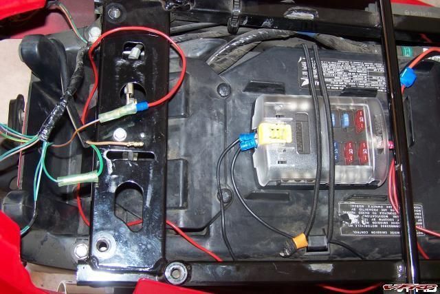
I purchased and installed another Zumo Power Cord and wired it to my previously described switched Bluesea fuse box. The rationale for the relay controlled input to the Zumo was that I did not want to have permanent power to the Garmin MC cradle. In this shot, I do not have the Zumo leads on the fuse box yet.
[image: Posted Image]

I ran the power cord up the left side of the bike between the seam of the frame and tank. I rigged the cord so that I could use the Zumo on the left grip housing or the tank RAM mounts. I wanted the option as I may need the flexibility based on the gizmos I strap on.

I ensured that I had enough cable for at least the Std/Med RAM arm which is needed to clear my tank bag be it on the left or tank RAM mount.
[image: Posted Image]
Please note that the short RAM arm is included in the Zumo package.

Alternatively I found another power cord option from Powerlet, which would work well with my BMW style Powerlet power plug in my stem. I prefer to keep my Powerlet free for other useless doodads.
[image: Posted Image]

I also tried out the long RAM arm on the center tank mount, which brings the Zumo up a couple of inches and is easier to see at a glance. This is probably how I will run my Zumo.
[image: Posted Image]

The long arm provides this view from the cockpit (helmet/rider view), when a tank bag is fitted.
[image: Posted Image]

N.B. I am sitting on my new Sargent courtesy of the VFRD. Thanks again. :thumbsup:

I fit the tank bag on all of my long trips and you need at least the Std RAM Arm to clear the bag.

For the moment, I will use my 3.5 mm IMC headset or earbuds for my Navigation prompts, MP3 tunes and cell phone input.
[image: Posted Image]

Downstream, I may rig a transmit capability for my cell but it is not a priority on the VFR. I already have that functionality on the Wing.
#32

[image: View Post]Laurent, on Mar 30 2007, 09:12 PM, said:

Hi,

I've been convinced. I'm supposed to receive my Zumo tomorrow. :salesman:
Where did you get your ram tank ball and all the accessories needed to install the zumo between the tank and the handlebars?

Thanks for the infos,

You will be happy.

Try the Ubolt Ram Mount and toss the Ubolt :rolleyes:

http://www.cyclegadg...asp?item=RAM-BA

These guys work as well as anyone.

You can see what the top part with the Ram Ball looks like here.
[image: Posted Image]

and here
[image: Posted Image]

You will need to get slightly longer bolts but almost any specialty bolt place has them.
#33
I had a question as to what wire I tapped to get the hot lead for the relay.

I have a 99 so here goes.

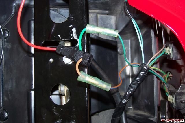
There are two wires coming from my licence plate light. One Brown and one Green. They are protected by a black wrap. This is confirmed from the wiring diagram courtesy of VFRD. All of the wires for all the lights go back into a common harness/rats nest also wrapped in black.

The hot one is the Brown. Green is ground. You can confirm the ground as all the other lights on the rear end use color wire in common - a Green ground. You can see that in the picture below.

Posted Image

I spliced into the brown wire - the green wire goes behind the Tconnector (in the picture) back into the black wrap.

To test, before I spliced I used my red relay wire to hook into the plug where the brown L. plate light lead was. You can see the existing connector that I used - it has a male connector. The test worked the relay worked and the L. plate light did not. Obviously the brown bare lead goes to light and since it was unpluged the L. plate light did not work.
Posted Image

Make sense?
#34
I am off to the Southern Sierras for a full road test of the Zumo and my Mapsource skills (?) When I get back I may be smart enough to write up a dumbman's guide/lessons learned to Mapsource and the Zumo. Maybe???

My last trip (May 06) to the High Sierras and numerous wrong turns were the genesis of my desire in the first place for a GPS/Zumo.

I reposted/expanded my original VFRD Sierra Trip Report below. Several new pictures are posted including some RC45s.

For you guys going to the GP, take a pass through the Sierras!

"Relatives and then the High Sierras on a VFR and a Wee in 06"

http://www.advrider....ad.php?t=217076
#35
More On the Road with the Zumo and Mapsource

Just got back from a 1,300 mile trip to the Southern Sierras and a full Zumo test.
[image: Posted Image]

[image: Posted Image]

The GPS gets high marks and more than lived up to my expectations. I took my Wing on this trip as the Zumo is fully integrated into my sound system and I have the cell transmit function setup and I was anticipating some slab work to get there and back. But do I have to apologize?

Oh yes, I also have heated grips on the big bird and have not installed mine on the VFR yet.

But first you have to talk about trip planning. I planned the four day trip on Mapsource 6.12.3. This is critical to know as there have been several recent upgrades/fixes to MS to better support the Zumo. Make sure you upgrade both MS and the Zumo, which is up to version 3.20 now (4changes/updates since Santa came).

There are three enormous advantages in using Mapsource with the Zumo over Street and Trips and trust me the list does not start with the user friendliness of Mapsource.

#1. Since the PC planning software map is the same when you find a place to stay in Kernville on your PC for example and then plug the route into the Zumo – the Pine Cone Lodge will be there as the map and POI/places databases are the same.
[image: Posted Image]

And Voila you follow the route and the Pine Cone is there.
[image: Posted Image]

#2 When you finish your trip and want to figure what you did versus what you planned you just have to load the trip logs into MS and you are ready to go to include loading the files into Google Earth with the touch of the mouse. This is the Borrego Campground, I showed a few thousand posts ago. You can also see the dotted track data on the Mapsource screen shot above as it heads north out of town as we tried to get over the pass the next morning – road closed though.
[image: Posted Image]

#3 When you craft a Mapsource route properly you do not build a lot of hard Waypoints like you have to do in Street and Trips to drive the route to a particularly twisty section whatever. You just use the route tool and change your route to accommodate your road preferences. The advantage of this is that you do not have a bunch of unnecessary flags/waypoints on your display which causes your Zumo to announce these places even though you do not care or want to hear about it.

You can see the waypoints/flags on this route constructed in Street and Trips or in MS if you use hard Waypoint – all of those flags interrupt your “Run the Ridges” MP3 file!
[image: Posted Image]

When you construct the route using MS and the route tool you eliminate all that.

This is a simple instruction set that I purloined off the Zumoforum website, which has replaced the old razorbike forum I posted previously.
http://www.zumoforum...php?p=2965#2965 There are more tips on the site.
1. In Mapsource, click on Route Tool. Click first (start) waypoint on map, scroll map to where your next waypoint should be, click again (2 waypoints will join), repeat this until you finish your route.
2. Is a waypoint in the wrong place? select 'Selection Tool' (arrow), click on waypoint to move, drag it to new position, click and revised Route is drawn.
3. Add additional waypoint into route? Right-click on yellow line of existing Route, select 'insert route selection', move (as 2.) to desired position.
4. Open Route Properties, untick 'Autoname', write your name fore this route in box.
5. Select Transfer / Send to Device, select Garmin, click Send
6. Unplug Zumo from USB, In Zumo click Yes to 'New Data Found', select Routes, click Import. Route is now in Zumo Route folder.

Here is another post that I had to read many times - “Mapsource Basics or MS for Dummies” – wonder why? Great stuff!

http://zumoforums.com/zumo/viewtopic.php?t...light=mapsource

Next - More MS and Zumo lessons learned
#36

[image: View Post]BonusVFR, on Apr 10 2007, 09:57 PM, said:

You can see the waypoints/flags on this route constructed in Street and Trips or in MS if you use hard Waypoint – all of those flags interrupt your “Run the Ridges” MP3 file!
That viappoints are announced like waypoints, was introduced with recent versions of Mapsource :( I hate it and I hope they fix that soon.
Tip from other gps forum: To reduce the number of flags, only put a waypoint at the start and the end of a route. Place viapoints on intersections where the route goes straight on. If you have to take a left or right at some intersection, put the viapoint at the next intersection where the route again goes straigh on. When a viapoint is placed on an intersection it is not announced.
This only works for the Zumo, on Streetpilots the viapoints are still announced.

Here you'll find a webapplication that takes a Mapsource generated route in gpx format and transforms the viapoints to hidden viapoints that are not announced on the Zumo. Use the button "bladeren" to upload your gpx file en press the button "verberg via-punten". Download the manipulated gpx file and upload it to the Zumo.
#37
I have suspended my lessons learned bit till I get this out of my system.

I did not want to do this but my hand has been forced by my woeful attempts to KISS. You do not have to be a GPS aficionado (there are other harsher words I could choose) to operate the Zumo or for that matter Mapsource. If you are one of those simpler down to earth guys stop reading here. My wife describles me that way except she uses the adjective lazy too.

Warning - if you do read on do not consider this the Gospel just another neophyte passing gas.

Unfortunately, there are lots of confusing terms in regards optimizing Zumo routes ie waypoints, viapoints, favorites, shaping points etc and ad nauseum points. But as you get into it you most naturally want to fine tune what they can do with the machine on tour. I am starting to move in the latter direction as I become more comfortable with the Zumo/mapsource interface. This is not an esoteric discussion as some of the above does change how your Zumo performs and talks to you literally.

But you can manage without most of it so go back to paragraph two if you still kept reading and really did not want to. You can get there from here or to here.
[image: Posted Image]

To get a grasp of the nuances of route planning you just have to read the Manual eh WRONG!!!!!!!!!!!!!!!! Those stinking Manuals are just to get you going or to make you dangerous so go back to para two again if you must!

No, you have to spend some quality time, surfing and experimenting with the MS/Zumo. This awareness does not come by osmosis or by doing this the night before while on tour. :beer:
[image: Posted Image]

You have got to work at it and there is no bible that I know of. Just a bunch of stuff written by good natured fools like me based on their experiences. Everybody is well intentioned but it is like trying to reverse engineer something much better to have the afore mentioned secret sauce but we do not!

Unfortunately this is also a moving target as both the Zumo and Mapsource software are changing concurrently. In other words what works today my not tomorrow as things change.

For example version 3.0 of the Zumo software offered this - "Added ability to treat certain route vias as shaping points which will not be flagged or announced. Qualified shaping points are Intersections and points on roads which are not addresses, such as I-35N or HwyA. Requires routes to be created with MapSource 6.12.1 or using the zumo route planner."

Whatever that means. Regardless, this is what V4 Rosso was alluding to in his post.

Ok here is the short course (intact) again lifted from others so I can proclaim "plausible deniability" or don't blame me if you take responsibility like I do.

Layman's Description of Waypoint/viapoints and Shaping Points source - http://www.zumoforum...opic.php?t=1132

"It depends upon if you want those points announced or if you are using them just to direct the route.

Here's the way I try to think about it. First of all, all the points in the route are viapoints.

Some are waypoints which are listed under the Waypoints tab and will be announced if they are inserted into the route. If you bring up the properties box, you can edit all the properties of the waypoint.

Some are shaping points which are special points that are placed at intersections to direct the route. The point properties box calls them a "map intersection" point and you can't edit the properties.

Some are neither. The point properties call them "map line" points instead "map intersection" points and you can't edit the properties.

For me Waypoints are places I want to stop along the route. Whether that's a restaurant, a scenic overlook, or whatever. I want the Zumo to tell me when I've gotten to those places. They are important to my trip. They will be flagged and announced on the route.

Route shaping points are points that simply exist on the route to "force" the route down that particular road. I don't need to have them announced because I'm not going to stop there. I don't even really care about the point itself. It exists solely to make the route go where I want it to.[b] If properly placed, they won't be flagged or announced on the route.

The points that are neither will be flagged and announced on the route. Sometimes this in a pain if the points aren't important to the route which is why there are shaping points. Sometimes though, there's no intersection for you to place a point and you have to place one of these.

When you are making a route in MapSource, if you put the viapoints on intersections, they will help "shape" the route, but won't be flagged or announced when you are routing. They exist solely to force the route to go down that road, hence one of the members here dubbed them PONI (points of no interest."


OK I am back albeit briefly here is a further explanation of the new kid on the block shaping points. Source - http://zumoforums.com/zumo/viewtopic.php?t...t=shaping+point

"Waypoints are saved locations (they show up in the Mapsource Waypoints tab) that may or may not be used in a route. If they are added to the route, they will be flagged and announced on the route. Also, of course, the route will be "forced" to that location.

Viapoints are simply points along the route that are added by the user. They may be Waypoints, shaping points, or neither. If they are added in accordance with the method described for creating Shaping Points, they won't be flagged or announced. If they are added by selecting the route and dragging it to a location that doesn't qualify as a shaping point, they will be flagged and announced. Either way, the route is "forced" to go to/through the location.

Shaping Points are points on the route that are created at intersections and points on roads which are not addresses. You can add them to your route by them by creating points along your route which meet these criteria. They will not be flagged or announced. The route will be "forced" through the location.

There's no "button" to change a Waypoint into another "type" of point. You just need to create a new point (and then possibly delete the other point if you don't need/want it).

Yes, when Waypoints are part of a route, they are called Vias because your route is going "via" that location. Otherwise, they are like Favorites. They show up, but they don't help define the route

In the Zumo, a waypoint is called a favorite. Waypoints is the old name Garmin have used until they invented the "Favorite", in the new series of navigators, where the Zumo is one."


OK I am done clear now??????? <_<

Do you wish you had finished at para two? I warned you. :wheel:

But with the Zumo and using the basics can get you to this easily
[image: Posted Image]

Next Simple Tips and Lessons Learned
#38
Sorry, but I have been thinking whether I should have weather on Zumo???? Don’t ask me more.

The Zumo does everything at this point except weather radar which I have seen on the 478 series and is very neat.

I am fairly spoiled in California in terms of local climate change, but I can see this would be real handy on a long tour. Before I go on a trip I look at the long range forecast but it only goes so far and is only so good.

The weather XM capability requires the add-on GXM30 antenna.

The subscription for the NavTraffic (which includes weather) is about 10 bucks per month. These shots borrowed from another user for illustration purposes only :rolleyes:

[image: Posted Image]
[image: Posted Image]
[image: Posted Image]

Really - lessons learned next
#39

[image: View Post]BonusVFR, on Apr 12 2007, 03:41 AM, said:

Quite a few have been surprised with the number of software fixes/upgrades the Zumo has received. More are expected. Garmin are responding to the MC side anyway.
Indeed. I heard a lot of Zumo owners complained that recalculation of the route is not optional, like the streetpilots, but that it will be after the next software upgrade.
Also, did you allready check out Zumo Connect on the Garmin website, where you can share routes?

Guess what, I thought the use of shaping points only worked on the Zumo, but I tried them with my SPIII and it works like a charm, they are not announced :thumbsup: It seems that that it works on the Zumo, SPIII and SP2610. the SP2720 & 2820 behave differently, that is, shaping points are still announced.
It takes a little more work to draw a route in Mapsource using shaping points, but at least you're able to draw a route without using that many waypoints. Biggest issue with uninteresting waypoints on a SPIII is that the SPIII is not that fast in redrawing the screen, which it has to do several times when you're about to pass a waypoint.
#40
Then there is “next generation” radar (NEXRAD) weather, which is not available yet on the Zumo. This is for the hard core tour and adventure guys.

[image: Posted Image]

Gee, I think I will pull under a tree or do the "Beverages on the Road" thread thing! <_<
#42
I know this is the VFR forum, but like you I have both a 98 VFR and a 2002 GL1800. I am considering the Zumo and was wondering how you connected the GPS to the GL1800 integrated intercom and soundsystem. Does it come with the Zumo or do you need a accessory from Kennedy or similar?
[/quote]

Why would anybody want a VFR and a Wing?
[image: Posted Image]

Anyway the install on the Wing is pretty easy. Use the RAM mounts that come with the Zumo to put on your left grip. I did use the med length arm but I am back to the short arm that comes with the Zumo package.

Next wire the Zumo power harness to the accessory terminals (which are switched) on the stock Wing fusebox and run the wire up (someway) to the left glove box area. Alternatively you can tap into the switched power connectors under the left glove box.

Go down to Walmart and buy a $5 dollar 3.5mm plug/wire extension and attach it to your Aux plug which is (you guessed it) under the left glove box.

Now you have a switched Nav/MP3/Cell receive capability.

If you want to talk on the cell through your existing intercom/headset call Jon at Goldwingadgets and buy the Kennedy GL1800 microphone integration components for about $115. That is what I did and would do again.
http://www.goldwingg...GPS.htm#ZumoMic

Jon/Kennedy do have a cleaner power plug/auxext/phone input harness, which is cleaner looking than the above but am not sure how much it costs.

I can talk on my cell thru the Zumo, which incidentally has a lot better screen than any cell. You do not need anything to listen to the cell on Wing once you plug the aux in and turn on your BT on your phone. Phone and Zumo link automatically. I just leave the cell in the glove box plugged into the 12v charger.

You have to turn on the intercom to talk on the cell – works fine. You have to monkey with the mute and stuff but you can figure it out when/if you get it.

There are more expensive and comprehensive Kennedy integration kits but this does the basics well.

Jon at Goldwinggadgets is a jock on GL systems.

Here is a diagram of how far you can go. Sorry VFR guys but this is important - you may need this stuff someday yourself....... <_<
[image: Posted Image]

Enjoy!
#43
Useful Things about the Zumo.

I have now played with the Zumo since the sleigh arrived in Dec and have pushed buttons during numerous short excursions on the MCs and truck. I planned two multi day trips where I built routes on the Zumo, and on the PC with Mapsource and Microsoft Streets and Trips.

The Zumo is very easy to operate. The touch screen and hard buttons are a snap to use even with gloves.
[image: Posted Image]

Here are some observations of what I like and use most so far:

First of all most new Zumo users will not appreciate how fast and how easily the Zumo homes on the satellites. You will take it for granted – well because it works very well and you have not experienced the delays associated with some of the older units. This is largely a function of the High-Sensitivity receiver or the SIRFstarIII chipset, which is considered to be the state of the art.

See - there is a reward for being late to the party or a procrastinator.

The redraw and recalculate times are even faster, which means you take the wrong road just to see what would happen the Zumo is instantly on the case unless you turn off or Stop navigating.

Whether you are in your garage, testing with your PC or in dense foliage or a canyon this thing never fails to get a fix and quickly. Even better when you are reviewing your route on battery at lunch or in some god forsaken establishment that evening, you will be able to calculate or change your route to fit your circumstances. While on the road I now know exactly where I am.

Knowing what is up ahead can be helpful in the twisties especially if you are riding a 900 lb motorcycle. But obviously watch the road too!
[image: Posted Image]

The feature I use the most is the distance to the next turn which is on the main screen. If you want a voice prompt beyond what the system gives automatically all you have to do is touch the lower right part of the screen and you get Jill or whatever babe you want to talk to you.
[image: Posted Image]

I like the fact that the prompt gives me the actual street name, ie text-to-speech, and distance as opposed to just take a left in X feet. This gets you looking for the sign precisely at the right time and actually improves your awareness I find.

Towards the middle of the day on tour, I start paying more attention to the ETA or Arrival time for the day. There are also two ways to get miles to go for the day either by getting to the MAP screen previously described.
[image: Posted Image]

Or by touching or sequencing the third hard button to the compass row screen.
[image: Posted Image]

This is of course all based on you loading one route for each planned day on the road. If your route or loop is longer than one day the ETA and miles to go features loose their bloom and value.

One significant bonus for the Zumo is that you can change your route on the fly and get an estimate of what it will take to get there ie miles/time.

Another especially useful feature on the road/tour is looking up the closest gas or hotels. Sure beats the heck out of cruising the town or even diverting into a town for a wasted search. Historically, I have planned with Streets and Trips and reviewed what town had dumps/gas in it. But on the fly, I just guessed. With Zumo I can instantly find what the choices are in Booneville USA. Now I see the choice on the screen, pick what I want and GO.

[image: Posted Image]

Rolling out of the twisties up to an intersection and not knowing which way is gas can be a problem. Go left or right I don’t know. No problem with the Zumo. I outlined the gas gage capabilities in an earlier post but that is prompted/alarmed by getting low as opposed to wanting to take a break and gas up at the same time.

Of course the Quality of dB is not perfect just like everything else. We pulled up to this place in Kernville on Zumo power – the price was right.
[image: Posted Image]

The main office. Friendly bunch with free continental breakfast.
[image: Posted Image]

Turns out the motel had moved down the street a touch. The places dB is of course out of date but tell me what set of records anywhere is not. Kind of funny though.

This one was in the dB.
[image: Posted Image]

My Outlook is controlled by me and guess what? It is not perfect either. As a former software company guy, I can appreciate the problem. Mostly right works most of the time on the Zumo.

Altitude feature when combined with the VFR/Wing temp gage gives you a sense when things could turn on you and what could be up ahead.
[image: Posted Image]

Ice on the road seems to be a fair indicator tooooo – Rt 168 by Lake Huntington.
[image: Posted Image]

I was not born with a cell phone as such as I indicated in previous posts I was skeptical of the whole Cell phone use on the Zumo at first. I am a believer now after using the feature on two outings.

And on last weeks Sierra tour, I called ahead and our dinner was ready when we crashed a buddies house for chow. Cool. Oh yea I can see the screen and cell functions on my Zumo about 100 times better than Razr cell.

More on Routing Next
#44
Just a note about extra storage and SD cards. The Zumo can now handle HC SD cards. I have loaded my 4 gig SanDisk card with my kind of music. As a guideline, you can anticipate as much as 500 MP3 Songs per gig, dependent the quality of your MP3s. Quality and volume are good.

When I play this … :music:
[image: Posted Image]

I am so glad I don’t have to use this anymore. :pissed: Note the khaki RAM mount and real time archive system for track logs. :unsure:
[image: Posted Image]

This is what I listen to while running the ridges in the Sierras. I hope to get to TN soon.
[image: Posted Image]

There is apparently a software driven 1,000 song limit for now. And make sure you put the MP3s on in a separate MP3 directory on the card as apparently the root directory can only handle so many songs.

You can save pictures and routes on the card. This is how you can pass routes to other Zumo users on tour too. Screen shots of the Zumo go into a separate directory on the Zumo itself.

Another database, I put on the SD card was the list of Honda dealers in the US. The dealer and other lists are available on the net in a variety of places. Maybe you want Starbucks dealers (I don’t) on your Zumo for example – you can have it.

You load these supplementary data sets (in this case a csv file) on the card using the Garmin POI (Places of Interest) loader, which you can download from Garmin. I used the beta version only because I am an early adopter – NOT. But I did anyway.

I don’t anticipate that I will use this because I have a VFR but……….

Let us say you are on tour and about to ride CA 36 from Eureka to Red Bluff which I hope to do in May. Before you launch off on one of the great roads of California, you feel like you need to check out the rumors of a RC-45 motor in the 7th generation VFR at the local dealer, apparently it is on the showroom floor – now!

7th Gen Prototype with Traction Control? Bags optional.
[image: Posted Image]

You know how to get there. Just follow the Red Wing that is on the Tank and the Zumo and Touch GO.
Places of Interest – Honda Dealers Eureka California
[image: Posted Image]

Route Lessons Learned next - sorry
#45

[image: View Post]25th VFR, on Apr 19 2007, 05:35 PM, said:

Really awesome write up. I just purchased my Zumo 550 and will get it installed tomorrow for my Saturday ride. Thanks for all the VERY DETAILED information. It made my GPS decision a snap.

One :offtopic: question though, if you dont mind, forgive me if you already posted the answers...I might have missed it amidst all your posts.

1. I would love to take advantage of the hands-free cell phone abilities. What is your method of using the Zumo with your bluetooth phone? I have a Blackberry w/ bluetooth and have looked at several products to get hands-free reception in my helmet. What is yours?

Thanks!

I answered this for the Wing at the top of page 4. Now for that lovely 25th version.

If it was me :pissed: ........and I did not have a headset and I was not getting a autocom/starcom type box, I would buy a Zumo rig (see pic below) plus a headset from Edsets. Their headsets have a fabulous rep with the Goldwing guys.
[image: Posted Image]

For me I could use this headset on my Wing or the VFR. :thumbsup:

The only problem with the Edsets would be that it might not work with the auto/starcom boxes as those guys use lots of proprietary connections. This would be a problem if downstream you wanted to add a RD or some other gizmo to your listening pleasure.

If you already have a headset/earbuds - what kind? Then you have to figure out if you want to jury rig a transmit capability or buy a new headset/mic combo.

Remember you do not need to buy anything to hear the phone if you have a headset already. Just turn on the BT on the phone and you are linked to the Zumo. Talking is the problem/opportunity.
#46

[image: View Post]BonusVFR, on Apr 19 2007, 08:56 PM, said:

[image: View Post]25th VFR, on Apr 19 2007, 08:34 PM, said:

Awesome information. So in conclusion, I will hardwire for MP3s and future XM, then I think I will just use Zumo BT and pull over if I need to contact the wife :D

But before you pull over and take off all your gear, you will be able to see that you have cell reception or if she called.

[image: Posted Image]


With the Zumo - you do not need to do this
[image: Posted Image]

Because you already know! Plus you can read the Zumo screen 100 times better than any stinking cell screen!
#47
Let us put this BT/Zumo thing in context: :rolleyes:

You are riding along enjoying this road, 190 in the Southern Sierras - export from Zumo track log to Mapsource to Google earth

[image: Posted Image]

Or you are storing pictures of the "bikes" at the Laguna GP race on your Zumo
[image: Posted Image]

Your Zumo is primed and ready to receive it looks like this.
[image: Posted Image]

And this happens - what do you do?
[image: Posted Image]

Wow! <_<

Is this a new thread?
#48
With regards to Route planning, I have done basically a 180 in my approach since December.

Previously in my posts, I outlined/restated some of the technical procedures used to construct routes, waypoints and shaping points etc. This time, I hope to give you a more conceptual approach to optimizing Zumo routes.

The only lesson learned I have mentioned so far really has been: one route – one day. :thumbsup:

Despite my predilection for S&T and its simplicity and effectiveness, I force myself to use Mapsource to plan my routes. I may use Street and Trips to plan with a broad brush, but not when I get to point of actually downloading a route to the Zumo.

Mapsource and Zumo together just have too many advantages to not use them for route making let alone the replay of the trip.

Initially my routes were a reflection of the way I used the Microsoft product – namely making waypoints/stops to force the route to specific mountain and scenic byways.

Hence when I made a route in Mapsource it looked like this. Note all the locations on the map which correlate with waypoints and ultimately Zumo Flags.

[image: Posted Image]

On the Zumo it looks like this – see all the flags which are waypoints or favorites.
[image: Posted Image]

Again the ramification of all this is that I would hear Jill all the time telling me stuff which was not critical to where I was going.

AND that was assuming that my waypoints were constructed properly :unsure: ...more on this later...!! <_<

With the old tank bag annotated map, a whole bunch of scribbling/notes is no problem as the human brain just ignores the irrelevant and focuses on what is important for the moment. That is a hell of smoothing algorithm – we should all be proud we have one.

Zumo is not that smart and has to tell you everything even if you do not care – cause it does not know what you mean just what you asked it to do – however unintentionally.

Using Mapsource with shaping Points at street intersections my routes now look more like this
[image: Posted Image]

See how the entire portion to the east was constructed without waypoints. I just used shaping points at intersections to make a seamless route.

In sum this is what I do now. I use the route tool and pick the start and end and let the computer have a shot a finding the route based on my preferences set in Mapsource. If I do not like it I use shaping points at intersections to drive the route to what I like. If you use shaping points at particular points as opposed to intersections it has basically the same result as a waypoint. Your via point (waypoint/shaping point) is announced.

Waypoints still have their place i.e. you want to stop at a particular place for lunch/view/pick up a friend, must see venues etc.

Some folks over at the Zumoforums are calling waypoints used solely to drive a route, PONI or Points of No Interest as opposed to the POI databases which are put in the Zumo because they have interest - my Honda dealers for example.

I went from Manual to Auto route making.

Now a word about setting up your preferences. From the new MapSource window, choose 'Edit -> Preferences' and then select the 'Routing' tab. For more scenic routes, it would seem that you should choose 'shorter distance' and set the road type slider more toward 'Prefer Minor Roads'. After all, VFRs are about twisty stuff right.

However if you set the bar too far towards the minor roads you will get on every feeder road in the western hemisphere, which can be a real pain trying to fix. :pissed:

Trust me you do not need the slider bar all the way to the left to see this in the Southern Sierras...
[image: Posted Image]

or this
[image: Posted Image]

or this
[image: Posted Image]

Imagine you are taking a major road trying to head to the hills – you could get off every exit and parallel on flop house row. :blink:

Anyway for what it is worth here are my current preferences.

[image: Posted Image]

Let me say this again with different words. Shorter Route or off highway routing tends to drive you to jump off the freeway/main road at every conceivable opportunity. I find it a lot easier to use the shaping tools to take you off the main drag once when you want to. As opposed to having to a route that has you off on the feeder roads every 2 miles. Remember you hit the highway trying to get across a hot valley quickly.

Next more on waypoint and shaping point placement and the pitfalls.

And Please Jump in here with more ideas!
#49
Route Lessons learned Part two

Now that we are all using some sort of points, here are a few tips to avoid mistakes that I alluded to above.

The key is to really zoom in to make sure you point is on the road otherwise this happens. This illustration shot is by a GPS maestro (Goldwinggadget) who runs an electronic firm supporting GPS stuff mostly for the wing. This happens to be a waypoint.

[image: Posted Image]

You see that because the viapoint placement was off the road the route got hosed. You really can not see what you have done if you are planning from 50K Feet.

Another issue I have had is if you mark a particular town to force a route, that town or at least the center of it is often off the road you are traveling. Hence you get minor diversions to hit the geographic or political center of the town. With the waypoint tool in Mapsource the town name will appear before you select it. Could be a problem? If I followed the Zumo to the letter a couple of times I have had to get off the road to hit the point even if it a one horse town.

With S&T it is so easy to hook a town to add to your route. God knows what is going to happen when you transfer it to the Zumo.

Here is what the properties of a shaping point (a via point too) look like if you have it right. :thumbsup:
[image: Posted Image]

Note that the Type of point 30 is a Map Intersection and it confirms it in the Comment section by giving the respective roads.

Then Test Routes in your Zumo, before you claim brilliance! <_<

When I was experimenting using a waypoint at an intersection, this is what happened. Obviously my aim was lousy. Be careful.

[image: Posted Image]
If you start hearing U-turns you probably screwed up and you better hope you are not in the lead or trying to act smart.

Next a little more about the Recalculation of the Route and Trip logs
#50
Great bunch of information here, especially with the pictures and explanations too.


Thanks for keeping this going guys. :thumbsup:
#51
Well I had another delicious morsel about "working around the Recalc issue" and "Trip Logs" but I will have to defer that because Garmin just blasted another upgrade out today.

Both of the major remaining complaints about the Zumo have been fixed/upgraded.

It is hard to bitch about the Zumo now when it looks like this.

[image: Posted Image]

And to think this is where I first saw it - the Zumo I am talking about.

WOW!!!

Changes made from version 3.20 to 3.30:

Added a user selectable Off Route Recalculation Mode
Updated Compass and Trip Computer displays to remember their last page mode
Enabled Bluetooth troubleshooting whenever a phone is paired
Allow volume adjustment when using a Bluetooth headset with audio option set to phone only
Added Lithuanian text language support
Corrected issues in Trip log archive support that resulted in 0 length files and false reporting of full logs
Corrected issue on Compass page that prevented it from displaying the heading
Corrected flashing on the Enter Coordinates page
Corrected issue that allowed the page key to escape from the pin entry for Garmin Lock
Corrected rare issue that could prevent proper startup when custom POI files contain a large number of bitmaps
Corrected problem ejecting on Mac computers

My reviews of the Recalc and Trip logs shortly.

Thanks
#52
Ok, now let us expand a little on Zumo Trip Logs

Previously, I talked briefly about the trip log capabilities of the Zumo. To review Tracks are what you actually did and routes are what you plan to do. The routes are what is/are preloaded into the Zumo by using Mapsource or by direct input through the Zumo “Where to” interface. If you are good and have the perfect plan your routes will be the same as your tracks.

This is how adept I am. Here, I am diverting around a closed gate at Huntington Lake in California. This is why I like tracks so I can figure out or remind myself what I really did.
[image: Posted Image]

I have found the tracks very useful as rarely do all my routes actually pan out as I had planned. Stuff happens! Plus they are great for reconstructing your trips/reports and to pinpoint exactly where took that photo (V4 Rosso pointed that out earlier).

The Zumo track log feature is fully automatic and you do not need to do anything to activate it. Please be aware, this includes when you are playing around with it in the garage or in a restaurant modifying/rescuing your trip. Every time, you turn the unit on the tracks are building and this screwing around does add a bit of clutter when you download the tracks later.

There are two type of logs/tracks stored on the Zumo. They are the active trip log and archive logs. First the active log:

The active log on the Zumo stores a couple of days of riding or many moments of fooling with the buttons. This log is what is automatically downloaded to Mapsource once you “Receive from Device” or link to the Zumo via USB. Track logs are loaded into the Track tab in Mapsource. The tracks are divided into segments which may include trips from hundreds of miles to a few feet (you turn on the Zumo to locate a beverage establishment while you walk around your hotel/dump room).

Here is a shot of my track logs from my recent Southern Sierra trip. All the tracks are in the left pane and my favorite mountain portion is highlighted on the right.
[image: Posted Image]

This is my favorite portion when I am on VFR skis. Sure! I like Mammoth and the Sierras and got their on Zumo power too. :thumbsup:
[image: Posted Image]

This unrelated screen shot shows my active trip log (as of today) is about 16% full. The active log holds about 10,000 points of track information and contains many different segments of the same trip.
[image: Posted Image]

This is where I also clear my active log and where you save segments of your trip log on the SD card as a route.

There are two things you can only do with the active log and NOT with the archive logs.
1. From the Zumo itself - Save a segment of a trip log as a route on a SD card.
2. Display all your tracks on the Zumo itself.

Before every trip, I clear the active log after I have dowloaded relevant portions to MapSource. That way I can assure myself I can do the two things above on the Zumo from the start of the trip if needed. You may want a log segment saved as a route because it was great and you did not have it on your original route or you want to pass it on to a fellow Zumo user. I also clear the Odometer reading.
[image: Posted Image]

Odometer and Trip data resets
[image: Posted Image]

To Review what you can show on the Zumo itself:

Show the trip log or make it visible on the Zumo. Maybe you want to retrace it.
[image: Posted Image]
Actual track
[image: Posted Image]

More on Trip Logs and Archive files :unsure:
#53
Archiving trip logs and displaying logs <_<

About the second day on the road the Zumo starts archiving the trip log. The active log always contains the most recent tracks and the archive files are stuffed into a directory on the Zumo automatically.

Warning if you have not saved that trip segment that you adored to a route by the time the archiving starts you will have to wait till you get back home unless you have a trunk for your PC.

I do ---- but I have the refrigerator in there right now.
[image: Posted Image]

Also remember, you can not show any of the tracks that are on the archive files on your Zumo just the active log tracks.

As an example on my April trip to Southern Sierras of 1,350 miles, I had 2 archive files plus the active log for 4 big days of riding (for me). The archive files are called 1.gpx, 2.gpx and so on. They are located on the Zumo itself in the Garmin directory then GPX and finally the Archive sub dir.

One of the bugs in the Zumo software that version 3.3 corrected was that some of the segments in the track log were missing. I lost about 150 miles out of my 1,350 trip for example. Not a problem any more though with version 3.3. Again well done to Garmin, they have really stepped up to improve this unit.

Note - both of my Sierra Trips are on advrider.com (one VFR and one Wing ride). My AZ trip is there too. Both of these VFR rides prompted (see recalc thread soon ha ha) me to get a GPS.

I shot this picture just as we missed our turn out of Sierraville to 89. Was that a right Jill? You had to be there I guess.

[image: Posted Image]

http://www.advrider....ad.php?t=217076

http://www.advrider.com/forums/showthread....hlight=hannagan

Typically the archive files contain up to 10,000 track points and are about 1,000kb in size. The Zumo can hold about 20 archive files. So ……..that means at least 3 weeks maybe a month or about two fortnights on the road before you max out the archive and active file storage capacity. That is provided you cleared your logs first before the trip started.

As a side note, unlike some other units the number of log points and for that matter how the segments are determined is entirely driven by the Garmin algorithm. Again this is a completely hands off function – the secret sauce again. Obviously if you turn off your Zumo a segment will end but it may also if you park alongside the road and leave the unit on battery.

Never mind really as you can combine various segments in MapSource later if you like. In fact by simply copying the track files from on archive file to a master trip file you can combine all of the active and archive tracks on one MapSource file.

I recommend at that point you delete all the 'crap' tracks like when you put your Zumo in your pocket while you moved into the woods for some privacy to save a tree or some endangered species of CA rat. Do you really need the track for this?
[image: Posted Image]

Here are the individual track points from a segment. All kinds of info here: Time; leg length, time, speed and course; as well as position for each point in the segment. There is also meta data on each segment.
[image: Posted Image]

Elevation Profiles are available too.
[image: Posted Image]

When you link with MapSource and use the “Receive from Unit” only the active logs are downloaded into MapSource. Now that you know where the archive logs are you can retrieve them manually. Keep in mind unlike the active log there are no waypoints or routes available on these archive files just tracks.

BTW - If you look carefully, the Zumo active log is contained in the Current.GPX file in the GPX directory on the Garmin Unit – not the SD card. The Current file contains a great deal more as well including favorites, routes etc. These files are also downloaded with you link up using the Mapsource link buttons. FYI, the other GPX file is the Temp.GPX which contains the active route on the Zumo. But don’t fool with either GPX file on the Zumo itself as you download the info automatically to MapSource when you use the MapSource link buttons. You would hate to screw up all your Favorites!

The actual track logs from both the active and archive files have identical information. You can display them in Mapsource.
You can see each log point on this file. When you start turning, Zumo starts adding more points to pin down your exact location.

[image: Posted Image]
Note that a track may be rougher looking than a route as each point is connected by a line which may look like you are missing a few apexes or no rhythm.

Then you can roll the tracks and/or routes into Google Earth
[image: Posted Image]

Posted Image

For more info - there are "How to Guides" on the Zumo forum. Although I am not sure this bit is in there.
http://www.zumoforums.com/zumo/viewtopic.p...asc&start=0

Next Up the "Recalculating the Route"
#54
As a warning: make sure you secure the Zumo in it's mount using the small screw, otherwise this can happen:
[image: Posted Image]
Zumo fell out of it's mount and was hit by a car.

Standard security screw. (click for larger image)
[image: Posted Image]

Custom made screw [image: Posted Image]

The SPIII mount comes standard with a screw similar to the custom made screws :huh:
#55
Recalculating the Route

As I mentioned in my earlier posts when the Zumo was released there were many GPS purists/experienced, who were concerned that with the Zumo, you could not turn off/modify the automated features. The primary concern was with the automatic recalculation of routes when you strayed off course.

Specifically they found the voice prompts were annoying and that your whole route would be changed with the recalculation.

My experience with whole recalculation process in general has been that the Zumo directs you back to the original route and the next via point but others have complained that the whole route is dumped.

Here I am off route and being directed back to the route route/waypoint.
[image: Posted Image]

I suspect the whole route would blow up eventually, if you kept ignoring the prompts and headed off stubbornly to find a new life. But there must be a thousand different permutations of how you could screw up the route and ways the Zumo could respond. I have only tested the 781 but can not wait to test the 1,000. :wheel:

Now some more background. What the Recalculation feature does ...............when you stray off course the Zumo immediately starts figuring a way to get you back on the route. This happens very quickly. There are several likely scenarios here:

1. You screwed up, are hopelessly lost and you welcome Jill’s assistance.

2. You deliberately took a detour (gas, break, lunch, view etc) but welcome the assistance to get back on route as you are in an unfamiliar place on tour. After all you would never stop to ask – right!

3. And a third situation when you get off the route intentionally, know where you are and start feeling like ….Well being nagged for instance. :pissed: Apparently in some males this initiates an irritating auto response mechanism that some females consider unpleasant if not rude. Frustration builds. And you want to shut the bi……… up.

First off, for the record, I never personally exhibit the immature and definitely short sighted attributes outlined above, but I have heard of guys who are like that but they mostly ride ……………. :unsure:

Well Zumo handled all three scenarios quite well even before the latest firmware update (3.3). In the first two scenarios, the Zumo goes with the flow. In the third, the Zumo operator can just touch STOP on the main screen and Jill shuts up. The GPS is still working and you still know where you are but no route is programmed.

[image: Posted Image]

I have used STOP a few times in lieu of shouting “SHUT UP”.

However, when you do that your route is not to be found on the screen – so it looks like this.
[image: Posted Image]

If you wanted your route back it was easy to load it again.

If first prompts you to whether you want to go back to the beginning of the route. The answer is up to you. But I would hate to start all over again.
[image: Posted Image]

You may see something like this when you are on route.

Beginning selected route
[image: Posted Image]

Not good enough so you need more features then? Here is what ver 3.3 did for us.

The new software update now gives you more flexibility with regard to the recalculation feature.
The Auto feature works pretty much the way the Zumo worked before and is the default setup
[image: Posted Image]

Now besides the Auto function they have added two more options: Prompted and Off
[image: Posted Image]

Here I have selected the Prompted recalculation mode. That is each time I stray off course it/she asks me if I want help.
[image: Posted Image]

With the Prompted selection when you stray off route you get this.
[image: Posted Image]

If you say Yes, Jill starts talking. If you select NO - silence. If only that would work in other parts of your life.

Here is what it looks like when you touch NO. Note you can see your route and where you are in relation to it.

[image: Posted Image]

When you turn the recalculation OFF, Jill shuts up but you can see the route on the screen (might have to change scale though) but Jill pipes up again when you return to your route for the next planned turn.

The Recalculation features and capabilities appear to be robust at this time. After all that for the moment, I think I will leave the default setup. :blink:
#56
This always happens to me... :unsure:

Also ordered:

Ram Mount (tank)
Long/Medium Ram Arms

Powerlet Steering Head Kit
Powerlet Powermate Kit (Power Tank Bag)

Monster Remote (iPod)

Held Fresh Gloves
Replacement X11 Dark Smoke Shield
Sidi Coolmax Socks :)
Joe Rocket Honda Interceptor Textile Jacket
Joe Rocket Alter Ego Pants

Need:

Switched Terminal Block Setup

I am going to power my zumo from my powerlet until I get a good solution for this problem.

It's like christmas!!!
#57

[image: View Post]Silver#788, on May 11 2007, 07:51 AM, said:

[image: View Post]BonusVFR, on May 9 2007, 09:19 PM, said:

For the moment on the VFR, I use an IMC headset which plugs into the 3.5 mm Zumo output just fine. "No cell transmit though......"

Hey BonusVFR go see what you made me do :joystick: My zumo now works fine with my bluetooth cell phone. [I can talk on the phone while railing twistys *SWEET*!!!!]
*Linkey*


I don't need to spend any more money!

Yours looks like an economical solution that works. Gets me to thinking!!!

I am still deciding what I am going to do on the VFR with the cell transmit.

Do something piecemeal and inexpensively or spend big $$$ and look at the big picture and integrate all the toys, RD, bike to bike radio, and Zumo into one package. I have the integration capability on the Wing but I also had a lot to start with.

Now for my pet MC peeve. :pissed: Of course as those of you have experimented know, none of the various speaker, amps, intercoms or for that matter anything are standardized so one set of speakers/mic/acc cords are not likely to work with another system. They don't even work if you are talking about plugging into a standarized 5 pin intercom/audio jack like on the Goldwing. I don't think there is lower headset cord that connects to the Wing audio, that will work with another manufacturers headset.

And another thing, if you do something practical like you did and then add another device, you are back to the drawing board.

I spent weeks investigating wiring up my FRS/GMRS radios to both of my bikes and I swear there is not a single radio with the same plug. 3.5mm, 2.5, 2.5 motorola, dual plug and on and on!

This is very frustrating and I am starting to get upset - have to ride now! <_<

May have to start another Tales of the ........... thread.
#58
Posted here per Request

So I really like my Zumo 550 but there are no good in helmet mics. I looked everywhere and decided I was going to have to make one if I really wanted it. I bought an Autocom unit to have bike to bike communication with friends but I changed my mind about using it when no one else bought one, also the ear pieces we not loud enough and hurt my ears. I did however use it with my cell phone a few times before I pulled it off the bike and found the mic was a really nice noise canceling mic that did not pick up road noise even at 90mph.

This is the Autocom Universal (Type A) Headset It was the base for my project. $75.00 direct from Autocom
[image: Posted Image]

First I took a mono audio wire [Radio Shack Part# 420-2434 $3.99] its about 3 feet long. I cut the ends off separated the 2 wires on either end and attached the male plug I removed from the Autocom unit to the wire. Pos.+ on the inside shielded wire and the ground.- on the outside then after a little soldering and a wrap of electrical tap on each I had this [will use shrink tubing for a nice finish]
[image: Posted Image]

Now to the 3/32" mic jack for the zumo 550. I found it at Radio Shack for $3.99 Part # 274-298 Note: this is a stereo version of the jack but it is ok.

First solder the ground [outside wire] to the base as clean as you can so the hard boot will fit over when your done.
[image: Posted Image]

Then solder the pos.+ [inside wire] to both of the open connections on the top of the stereo plug [making it a mono plug ]
[image: Posted Image]

When your done trim off anything sticking out so the housing fits.
[image: Posted Image]

Close the housing and slide on the lock ring for the housing [its a small black o-ring that comes with the jack]
[image: Posted Image]

Now I have my cable to hook my mic to my Zumo

[image: Posted Image]

Here it is hooked to the mic
[image: Posted Image]

This is my cable hooked to the zumo bike mount
[image: Posted Image]
Here is the mic in my flip face helmet
[image: Posted Image]

Female 2 pin connector out of helmet
[image: Posted Image]

And last my in ear plugs with in line volume control from radio shack
[image: Posted Image]
[image: Posted Image]

All said and done total price was under $85.00 including the total cost of buying the [Universal (Type A) Headset
Universal Headset for use with all style helmets (full-face, open-face flip-front and half).
Part Number: 1153] and the other small part.

I NOW HAVE A HIGH QUALITY MIC FOR MY ZUMO 550 I WOULD HAVE GLADLY PAID MORE FOR IF I COULD FIND IT.

Also BonusVFR THIS IS ALL YOUR FAULT SHOWING UP WITH YOUR NEW FARKLED TOYS AND GETTING ME ALL EXCITED!!! THANKS MAN ITS THE BEST
#59
Well after reading the earbud mods described above (thanks Silver) I decided on a tunes test with my current VFR setup.

Another great ride day in San Diego :thumbsup: - a few CRs out after breakfast including a 1098.
[image: Posted Image]

I parked to the side and you can just make out the Zumo.
[image: Posted Image]

First here is a shot of my preferred mount setup. Center RAM ball with med arm. I have a mini sized tank bag in this shot. And sorry about the tank bag strap – but you get the idea.

[image: Posted Image]

This is about how it would look from the cockpit – the angle I mean. I don’t have telephoto eyes any more though.

[image: Posted Image]

I tried my IMC headset with earplugs and my MP3 earbuds.

I have MP3 earbuds plugged in here.

[image: Posted Image]

Note - keep the RAM lock/adjuster on the left side for emergency tightening (real important if you have a HD).

Heretofore with the VFR, I have focused primarily on the quality of the Navigation prompts. This time I tested the Zumo/headset MP3 capabilities.

I picked the most demanding tracks (highs, lows, whispers, booming male/female voice and sound tracks) I have. The songs are from the Phantom of the Opera soundtrack.

My IMC headset with earplugs did not cut it. However, this set is designed primarily to support my FRS/GMRS radio system. I did not adjust/move my speakers in my Arai Corsair. I just did not have enough vol with the earplugs in to pick up the whispers/soft voices on the track. The earbuds worked great but I am worried about comfort when I ride for the full day.

The bottom line – the search is on for my VFR speaker/earbud system. The Wing's Zumo tunes are fantastic but I do not ride with earplugs on the big guy, have a separate amp, and the speakers are high quality and better placed.

Any recommendations? I am trying to get feedback from Edsets users but may opt for comfortable earbuds as an interim solution.
#60
Local routes update

Of late I have been using my Zumo even on local routes that I know well. For some reason I have been meeting up with other riders for breakfast etc, miles away from my home.

[image: Posted Image]

Essentially I have been plugging in the destination town direct on the Zumo and getting a rough ETA so that I know if I have to add/reduce speed to make it on time. Very Handy!

ETA only good if you are on route
[image: Posted Image]

However if you have the Recalcualtion off (which is my default position near home) and you do not follow the recommended route your ETA goes to hell quickly and can be very misleading.

It is set on Auto here but when local I select OFF.
[image: Posted Image]

This is what the route looks like when you are doing your own thing and not recalculating.
[image: Posted Image]

Tip of the day - when you are on the road you want, just touch Detour to got an updated route and accurate ETA to your destination.

And then :wheel: because you are probably running late. <_<

Stop and Detour Navigation functions.
[image: Posted Image]
#61
After reading many threads, I opted for these JVC earbuds till I get a permanent solution to getting the sound from my Zumo on the VFR.

[image: Posted Image]

They are inexpensive and comfortable. We will see if I can handle them for a full day on the road. As regards Music quality that remains to be seen.

Embarking on another CA tour and test of the Zumo.
#62
What happens when your actual track is better than the planned route and you want a better route for the future. You can convert the track to a route.

There are two ways to do this:
1. Convert segments of your active log into a route and save on the Zumo or the SD card.
2. Later when you download all the archive and active logs into mapsource, you can then upload relevant tracks back to the Zumo for conversion.


Here is a famous road bike route in CA - RT 36. :thumbsup: I downloaded all the tracks including RT36 from my 2,500/1400 on VFR mile CA trip to Mapsource. Copied the RT36 segment of the track to a clean Mapsource file. I could have changed the name of the May28 track too - but it was my birthday.

[image: Posted Image]

Then I saved the RT 36 GPX file on either the SD card or the Zumo in the Garmin/GPX directory. When you boot up the Zumo the new data will be recognized for import or you could wait and import later using the import data function.

[image: Posted Image]

The other tracks here were from a set of tracks off a generic 276 type Garmin I got off the web.

The Zumo auto converts the track to a route - Then you take a look at/check your new route - complete with voice prompts/directions/mileage etc.

[image: Posted Image]

California has great roads! Come on over, visit and don�t pay any state taxes!
#63
This thread got me. The content is amazingly helpful. :thumbsup:

PCNation now has one less Zumo to sell. :)
#64

[image: View Post]sportrider, on Jul 15 2007, 10:15 PM, said:

This thread got me. The content is amazingly helpful. :thumbsup:

PCNation now has one less Zumo to sell. :)

Thanks - plan on a "Lessons Learned update" from my recent CA tour.
#66
Here are a few observations and Zumo lessons learned from my recent VFR California tour

The bottom line is - it is a must on tour for me ........ranked right there with heated grips, electric vest, a Sargent and good tires. :thumbsup: :beer:

Mounting Considerations:

I started out using the RAM med arm on the center tank RAM mount. You can see the Zumo sticking out. It is quite protected in there and is less susceptible to damage.

[image: Posted Image]

I switched to the long arm when my RAM mounted camera crapped out. After two days of using the long arm, I find that I prefer that setup with my touring tankbag. It provides slightly better screen visibility and allows better access to my stem mounted Powerlet power plug. When using a big tank bag, you can place it more perpendicular to your line of sight which also helps reading the display. I am 6ft short.

Long Arm � note that your view of the VFR gauges is not blocked.
[image: Posted Image]

[image: Posted Image]

The medium arm works well for the smaller tank bags, which I run with when not on tour.
[image: Posted Image]

There are some very clean looking RAM compatible options out there including this rig which I saw on the weekend on a group of ST1300s. :idea3: This part bolts on the brake reservoir and replaces the stock cover and looks like it works on all modern Hondas.

[image: Posted Image]

I am considering this RAM mounting option, not for my Zumo but for future electronic warfare devices

Cyclegadgets.com and RAM itself have derivatives of the same basic replacement reservoir plate.

I still like the switched power to the Zumo through the Bluesea fuse box that I previously described.
[image: Posted Image]

I may alter how my Garmin power cord is plumbed. The original install gave me the option of rigging on the center tank mount or the left grip, which is capability I will not use now.
[image: Posted Image]

Too bad nobody makes a shelf/dash rig like this home made contraption on my tour compatriots RT 1100.
[image: Posted Image]

My install on that other bike.
[image: Posted Image]

More on routing, day to day use and getting the sounds out.
#67
I'll second every good thing about the Zumo.

I'll add that I had powerlet fashion a steering stem cord for the zumo and the sirius. Simplifies wiring.

I'm also trying Ram's triple ball mount -- it allows me to mount the zumo and the sirius radio off the gas tank ball mount.

I only have two short stems, so I used a medium off the gas tank ball mount, and then the two short stems for the gadgets.

Seems to have worked ok on my recent 4 day/2600 mile tour. :thumbsup:
#68

[image: View Post]sportrider, on Aug 7 2007, 03:26 AM, said:

I'll second every good thing about the Zumo.

I'll add that I had powerlet fashion a steering stem cord for the zumo and the sirius. Simplifies wiring.

I'm also trying Ram's triple ball mount -- it allows me to mount the zumo and the sirius radio off the gas tank ball mount.

I only have two short stems, so I used a medium off the gas tank ball mount, and then the two short stems for the gadgets.

Seems to have worked ok on my recent 4 day/2600 mile tour. :thumbsup:

This thing?

[image: Posted Image]
#69

[image: View Post]BonusVFR, on Jul 31 2007, 07:51 PM, said:

This part bolts on the brake reservoir and replaces the stock cover and looks like it works on all modern Hondas.
..
I am considering this RAM mounting option, not for my Zumo but for future electronic warfare devices
I am looking for another RAM mount as it would be nice to be able to use both my camera and Streetpilot at the same time. Not sure though if this brake reservoir ball mount has enough clearence to the windscreen when the bars are at full lock :unsure:
#70

[image: View Post]BonusVFR, on Aug 6 2007, 11:33 PM, said:

[image: View Post]sportrider, on Aug 7 2007, 03:26 AM, said:

I'll second every good thing about the Zumo.

I'll add that I had powerlet fashion a steering stem cord for the zumo and the sirius. Simplifies wiring.

I'm also trying Ram's triple ball mount -- it allows me to mount the zumo and the sirius radio off the gas tank ball mount.

I only have two short stems, so I used a medium off the gas tank ball mount, and then the two short stems for the gadgets.

Seems to have worked ok on my recent 4 day/2600 mile tour. :thumbsup:

This thing?

[image: Posted Image]


That's the one! :thumbsup:
#71

[image: View Post]V4 Rosso, on Aug 7 2007, 11:44 AM, said:

[image: View Post]BonusVFR, on Jul 31 2007, 07:51 PM, said:

This part bolts on the brake reservoir and replaces the stock cover and looks like it works on all modern Hondas.
..
I am considering this RAM mounting option, not for my Zumo but for future electronic warfare devices
I am looking for another RAM mount as it would be nice to be able to use both my camera and Streetpilot at the same time. Not sure though if this brake reservoir ball mount has enough clearence to the windscreen when the bars are at full lock :unsure:


The RAM mount that is packaged with the Zumo works well on the left grip. Works great for a camera as long as you have a Long Arm.
[image: Posted Image]

Here is another shot of a camera (now defunct) with long arm on left grip and the Zumo on center ball with med arm.
[image: Posted Image]

Way too much distortion on VFR screen to shoot thru. Have to use a long arm on a camera from left grip.
[image: Posted Image]

I also tried using the two Ball mount on the left grip which I use on the other bike.

[image: Posted Image]

Two Ram Ball on left grip of my other bike - what is it called but it does have a SSSA? Both the camera and Zumo are on the left grip RAM two ball mount.
[image: Posted Image]

Too bad that there is not enough clearance with the VFR tank for the two ball mount - so that is out as an option!

You could use another mount on the right grip but it had best be used with gear that does not need much handholding so to speak! Maybe a RD?

Brake reservoir plate, I think would work/clear if you use/reverse it so the Ball Mount is on the right side of the reservoir.

[image: Posted Image]

I like Sport Riders idea of three balls (how could you not like three balls). :thumbsup: However Cyclegadgets warns that the load may be too great for MC use. :pissed: <_<

SR do you have a picture??
#72
I think they mean the three ball extended and then weighted. This setup uses a short arm off the gas tank so there isn't much extension loading. I used a short arm for the zumo and a medium arm for the satellite radio (I didn't have 3 short arms). The power comes from a custom Jastek cord to a steering stem outlet. Custom satellite radio rain cover by Ziplock. ;)

This setup held for my recent 4 day 2600 mile loop. I can move the zumo or sirius back to the resevoir mount if need be. Ride safe. :wheel:


[image: Posted Image]
100_2806.jpg

[image: Posted Image]
100_2804.jpg

[image: Posted Image]
100_2805.jpg
#73
Today I rode with a guy who just put in the Brake RAM mod on his ST1300. This RAM attachment point looks pretty good and much cleaner than the handlebar grip add on that I have on the VFR and Wing.

Here is the Motorcycle Larry Brake Reservoir - comes in Model T black and Silver.

[image: Posted Image]

Sport Riders Triple RAM Ball kind of appeals to me as well. But I have to get another gizmo first.

After the debacle I had with my JVC earbuds on my California tour, I had to do something different to optimize the sound on my VFR. I tested out some Zumo sound mods today.

Here is my summary of earbud experience from my CA tour report .........

"....My JVC earbuds did not cut it. Forget fidelity, my hearing is shot anyway. The darn things kept getting pulled out when the cord got caught on my tank bag. Makes me appreciate the coiled cord and speakers/helmet speakers on my Wing. When I returned, I took my speakers out of my Arai and positioned them closer to my ears. Sound is now restored to both ears. Looking at other options though."

But I will probably not use my Arai Corsair on tour anymore.

[image: Posted Image]

For me, earbuds are just uncomfortable and are prone to being pulled out and are hard to put back in without taking off the helmet and starting from scratch.

So, I purchased an extender cord with 3.5mm stereo plug in for my Airrider Wing headset intercom rig. They are installed in my flip up HJC which is now my preferred tour helmet as well. Plus I can still use this helmet with my Wing anytime.

Here is a shot.

[image: Posted Image]

The coiled cord plugs into the headset/helmet (top of photo) and the 3.5 mm extension on the left plugs into the Zumo MC mount and to the end of the coiled cord. This end normally would plug into the Wings Intercom hookup. The coiled cord is a must, which you do not appreciate till you do not have it.

Unlike the Edset headset with Zumo attachment I talked about in a previous thread, my new VFR airrider addon does not allow me to talk on the Cell through my mic. If I bought a headset today I would buy the Edset and the Zumo attachment so that I could use the helmet/headset on the Wing and the VFR.

Too bad there is no standard so that one headset will work with another guys attachments. :pissed:

[image: Posted Image]

The speakers in my HJC are right next/flush to my ears. I have to turn the Zumo volume down when I ride without earplugs. Noise level is not too bad now that I have replaced a missing bolt for the visor on one side.

With high quality foam earplugs the sound level is adequate but needs a jolt to be first rate, especially at warp transit speeds. I purchased some different earplugs which are supposed to cut wind noise but not attenuate voice. Sure?! :unsure: I may have to get a powerbooster of some sort, but I will most likely get one once I get my RD.
#74
Ok, I just jumped back into Mapsource to lay out some routes for my upcoming swing to Colorado. So here are some lessons learned from my recent CA tour where both my buddy and I had Zumos.

[image: Posted Image]

Before a trip I like to�������..

First off - I like to clear out my old routes and favorites/waypoints files from previous tours. It just makes it cleaner to find the relevant destinations when you are on tour. I have not had a memory (Zumo that is) issue yet but clutter is something I do not want on my Zumo.

My garage is another matter. <_<

Get rid of old and non relevant routes etc � you always have them and the old tour track files on Mapsource if you want to use them again.
[image: Posted Image]

I also like to clear out my screen shot and archive gpx directories, so I do not have to sort out what was from the previous tour when I download stuff from a tour.

Remember, when you construct routes with Mapsource and the Zumo use shaping points so that you can eliminate unnecessary voice directions and flags on your Zumo. I mostly let the computer pick the route and then correct using shaping points.

You can tell a proper Shaping Point because it has in the Type field it is call a "Map Intersection" and in the "Comments field" the both roads are labeled ie "VFR rd and Wing way".
[image: Posted Image]

One from my next tour on the way to CO - getting hot in AZ.
[image: Posted Image]

Then you upload your routes and waypoints. Waypoints turn into favorites on the Zumo. It is important to remember that all waypoints do not have to be in your routes. You do not want to download tracks and if it comes up you probably did not have a clean Mapsource file when you started building your trip.
[image: Posted Image]

You could dowload tracks from somebody else to turn then into a route on your Zumo.

Having extra waypoints is real handy on tour if you want a detour or look at a detour option quickly. You can also get quick mileage checks/options if you want to alter your route.
I build in extra waypoints (that are not in my routes) that I may want to visit if it suits me. If you get tired you can also use the favorites to get direct routes to alternative destinations

You should get a "New data found would you like to manage this data now" alert. And then.................

Your Data successfully imported
[image: Posted Image]

In a perfect world :unsure: , you would want to expand the scale on your Mapsource and even the Zumo screen to really check out your route. You could get one of these perhaps. But frankly I do not spend a lot of time blowing things up (I used to do that a long time ago). I just go with the flow.

[image: Posted Image]

Next on the road.
#75
On the Road Utility

Many of my previous tours had been plagued by Navigation Errors. Indeed this prompted the use of FRS/GMRS radios and sporadic map stops to resolve gentlemanly and respectful disputes about which way to go. And what the Heck/F�� are you doing???

Here we are missing a turn in the Sierras in 2006���..

That should be a right!
[image: Posted Image]

Occasionally, I even had to engage the gear whine warp drive motors to chase down my fellow rider, whom I let with regret, take the lead.

This was my first tour where both my riding buddy and I had GPS units � Zumos! What could go wrong? More on this later in this interminable voyage.

As the keeper of the Navigation trust (easier to get blamed that way) and a software guy, my charter was to develop routes in Mapsource.

The job was done and I emailed the routes to my colleague. Of course, I followed my maxim of one route for each day. Following the protocol in the post above, one can easily upload the routes to your Zumo.

It is not critical that the routes be perfect. For example don�t spend too much time on the last mile i.e. for example if you do not where you are bedding for the night. Just crank something in.

Here is an example, I used Curry Village as my stop point for my swing into Yosemite Valley even though Lower Pines Campground was my final destination.

Curry Village is straight down.
[image: Posted Image]

I did not know the exact camping site, so I did not try to locate it on Mapsource. Later I was able to use the Zumo to mark the exact spot (see "Lower Pines Camp" marker in Mapsource below) as a waypoint/favorite to be used in future routes. Indeed spots you mark by pressing the Motorcycle Icon on the front screen load into your Zumo favorites file and will be downloaded when you finally hook up the Zumo to Mapsource at tour�s end. You can also see my tracks to the site.

[image: Posted Image]

Right there.
[image: Posted Image]

After two days of rest I just loaded the next days route into the Zumo and proceeded to the start point. If I had been unfamiliar with the area, I could have just opted for this����.

Navigate back to start of route
[image: Posted Image]

As a matter of routine, I set my Zumo Recalculation Mode to Off, except in cites/dense urban areas where I set the mode to Auto.

Auto recalculate modes
[image: Posted Image]

[image: Posted Image]

This minimizes button pushes when lane splitting in San Francisco and disturbs one less when you jump off the road to look at something like this and know perfectly well where you are.

[image: Posted Image]

If you do get off route and need help you can easily switch back to "Auto" or "Prompted" Recalculation or better yet just hit �Detour� to get direction back to your route.

[image: Posted Image]

This also works when the road is chained off.
[image: Posted Image]

Should you both be in the Same Mode?
#76
As a side note when we navigated this piece of road South East from Lassen NP there were entirely different reactions from the two Zumo riders depending on the Zumo Recalc mode and "other factors".

[image: Posted Image]

My BMW buddy has his Zumo set on Auto recalculation mode.

I have mine shut off which is the default position for me except in large metro areas or perhaps when I want to explore a neighborhood. In the hood, I just set the destination to a point on the other side of the maze and just ride around, explore and let the Zumo pull me out.

Now my RT partner has a problem that he has not come to terms with. :unsure:

It is not his plumbing but something much more important on tour.
[image: Posted Image]

His wife seems to support him though - no matter what - unconditional L......... or ............. :wheel: .

In essence, he is totally on voice as he is blind unless he uses his reading glasses and then he can not see the road.

I have a competitive advantage as I have the latest dual pane correction devices. A man has to know his limitations. :pissed:
Posted Image

He panics as he gets one continuous recalculating message that he is off track and all I have to do is look at the screen and see we are going to join up with the route in a couple of miles or so. He can not see it though - this is a problem!

If this happens all you have to do is tap the screen to get another perspective and see if you need to do anything.

Have to hurry with this post as I am off to Durango by Zumo. Guess which bike I am taking.

[image: Posted Image]
#77
Another note on the Zumo

When you are on the run and pull up a new destination be it a town or a gas station. Be advised that these distances and direction are as the crow flies.

Mt Laguna
[image: Posted Image]

If you are stopped and do the same thing you get cardinal points of the compass. BTW this is the safer way to go. Even though the hard buttons and touch screen are very easy to use.
[image: Posted Image]

Actual route to Mt Laguna and miles. Add another six miles or so!
[image: Posted Image]

This can be a little disconcerting at first but the Zumo can not simultaneously compute and continuously update multiple routes at one time so it gives the crow distances and you pick one and see if it works by calculating the route.

Bon Voyage
#78

[image: View Post]BonusVFR, on Aug 16 2007, 05:49 PM, said:

In essence, he is totally on voice as he is blind unless he uses his reading glasses and then he can not see the road.
That sure is a disadvantage. I sometimes find that when I solely rely on voice prompts I end up taking a wrong turn. Particularly at roundabouts the directions are not always correct.
#79

[image: View Post]V4 Rosso, on Aug 16 2007, 05:30 PM, said:

[image: View Post]BonusVFR, on Aug 16 2007, 05:49 PM, said:

In essence, he is totally on voice as he is blind unless he uses his reading glasses and then he can not see the road.
That sure is a disadvantage. I sometimes find that when I solely rely on voice prompts I end up taking a wrong turn. Particularly at roundabouts the directions are not always correct.


Yea that is where I come down too. Originally I thought Voice would be enough but apparently I need more help!

Most of the time I get in trouble now is when I don't believe Jill???? I should know better after all I am married. :unsure:

Sometimes Mr. ZUmo is saying one thing and the sign has another name. Most always the same road though. But you have the problem big time with maps too.
#80
here is my tale of zumo. I recently upgarded from a garmin 2720 to a zumo 550.
so two weeks ago I ride out to the country and travel some of my favorite roads I decide to go to Pa and visit a friend after
then the fun begins, I enter my parents home address and the zumo calculates the route but has no arrival time, this is my first indication that something is not right. I start to look at the route that my zumo wants me to travel and the route goes straight west from pa to ohio and further west, then up into Canada yes Canada and then back east and south to Long Island NY.
[image: Posted Image]
zumo goes kuuku.JPG

so then I enter my home address and it gives me the same directions, I shut the unit off and the powered it back on and tried again, same thing, so I go to prefences and change the zumo from fastest time to shortest distance and finally the zumo starts to work then I changed it back to fastest time and zumo gave me the correct directions home.
since then I have used it twice and so far so good I like the fact that I can listen to my music without an Ipod, I think that the sound quality is very good and having the volume control right on the unit is much better that digging in my pocket for the Ipod.
also very usefull is the bluetooth function, I did not put a mic in my helmet but now when my phone rings the volume mutes and I can answer the call and listen in on what they have to say, my wife already knows to just speak that I can hear her and if it is important then I can just pull over when safe and call back or just ignore the call and send them to voice mail.
#81

[image: View Post]mellowyellow, on Aug 27 2007, 11:46 PM, said:

here is my tale of zumo. I recently upgarded from a garmin 2720 to a zumo 550.
so two weeks ago I ride out to the country and travel some of my favorite roads I decide to go to Pa and visit a friend after
then the fun begins, I enter my parents home address and the zumo calculates the route but has no arrival time, this is my first indication that something is not right. I start to look at the route that my zumo wants me to travel and the route goes straight west from pa to ohio thru and further west then up into Canada yes Canada and then back east and south to Long Island NY.
i tried several times to stop the and re entered there address but zumo kept calculating the same route, then I entered my address and zumo calculated the route to my home but the same way.

I once had a similar experience using mapquest getting around NYC on business - routing took me to Chicago wherever that is.

A couple of folks experienced something similar before the software upgrades. I never did. Have you upgraded the software on the Zumo?

How are your Avoidances set? Did you talk to tech support?

Sometimes I have done some route programming but failed to hit GO and I got the same route till I went past GO and collected $200. :unsure:
#82

[image: View Post]BonusVFR, on Aug 27 2007, 07:59 PM, said:

[image: View Post]mellowyellow, on Aug 27 2007, 11:46 PM, said:

here is my tale of zumo. I recently upgarded from a garmin 2720 to a zumo 550.
so two weeks ago I ride out to the country and travel some of my favorite roads I decide to go to Pa and visit a friend after
then the fun begins, I enter my parents home address and the zumo calculates the route but has no arrival time, this is my first indication that something is not right. I start to look at the route that my zumo wants me to travel and the route goes straight west from pa to ohio thru and further west then up into Canada yes Canada and then back east and south to Long Island NY.
i tried several times to stop the and re entered there address but zumo kept calculating the same route, then I entered my address and zumo calculated the route to my home but the same way.

I once had a similar experience using mapquest getting around NYC on business - routing took me to Chicago wherever that is.

A couple of folks experienced something similar before the software upgrades. I never did. Have you upgraded the software on the Zumo?

How are your Avoidances set? Did you talk to tech support?

Sometimes I have done some route programming but failed to hit GO and I got the same route till I went past GO and collected $200. :unsure:

my Avoidances were tolls and traffic I also had the wass egos on and have since shut them and leave it on just gps
#83
Ok so here I am in CO, heading North out of Telluride on CO 145 about 8 in the morning������when what to my wondering eyes should appear but a silver VFR and one reindeer GS. Both just full of bags, presents and tour crap.

A quick snap from my RAM mounted camera and a photedit blow up and you get this

Who is this?????????? Help!!!!!!!! :huh:
[image: Posted Image]

One of the cool things about the Zumo is that you can get a good fix on exactly where you took that photo by comparing the time stamps of your photos and the Zumo track logs.

[image: Posted Image]

The kindaaaaaa Blue segment in the middle is where I shot the VFR photo � I was on the move. You can also see what my backtrack loop and pull in to the South looked like when I had to go rescue my buddy who had pulled into the only MC shop he had seen in the Telluride area.

If it helps stir the memory, I was riding my other bike at the time � the one with the AC duct. ����������.And after reading the Cruiser Bashing thread, there should be no inappropriate, insulting, offensive or fat joke remarks. :beer:
[image: Posted Image]
#84
You can find some nice software on the net, that can geocode your pictures by writing the location into the exif data. All it takes is the tracklogfile and a list of picture files.

Gpscorrelate is an example of such software
[image: Posted Image]
#85

[image: View Post]V4 Rosso, on Aug 28 2007, 04:10 PM, said:

You can find some nice software on the net, that can geocode your pictures by writing the location into the exif data. All it takes is the tracklogfile and a list of picture files.

Gpscorrelate is an example of such software
[image: Posted Image]

Cool. Thanks. I may have to screw with that as well........... More time lost <_<

The problem I had initially was that I did not change the time zone on my camera ........but I did on the Zumo.
#86
Records and Such

When first released the Zumo did not indicate altitude but did record the information in the trip logs. Sometime in early Spring, the altitude reading was incorporated into the compass row screen.

My previous record for Zumo altitude documentation was atop Tioga Pass in the Sierras during my CA 07 tour.

Almost 10,000 ft and you have to pay to make a recording�������
[image: Posted Image]

[image: Posted Image]

Despite the fact that the Sierras boast the highest mountain in the lower 48, I was able to set some new altitude records on my recent CO tour.

When the Zumo gets about here �����..
[image: Posted Image]

It starts to have problem��������..
[image: Posted Image]

Which is easily fixed by switching to this new measurement system � which was just invented. :unsure: You just have to believe that 5,280ft in a mile is a lot simpler to understand than that difficult to fathom (6ft by the way) metric/decimal creed.

It is kind of reverse of what I experienced when I lived in England as a kid for a couple of years. I learned :pissed: all about Pounds and Shillings (back then 20 to a pound unless you were talking about a guinea of course) vice the dollar system (how crazy is 100 cents to a dollar anyway) I was familiar with.

Anyway � somewhere in CO????????? :wheel: actually on a Wing and a prayer.
[image: Posted Image]

I would convert that to feet but I do not know how.

BTW, the Zumo is usually within 20 ft or so of the posted signs on the hill.

And of course on the way back to San Diego, I sunk ................................... :rolleyes:
#87
This is a repost of what I put on Zumoforums:

The question is how do you get miles to the final destination - easy page to the compass screen or Map your directions. But how do you get total miles to a midpoint/lunch etc

I have found that one day of tour should be one route. That way you can get miles to final stop of the day with just a few keystrokes. Also the ETA on the main screen is relevant.

My tours decay too much after a couple of days to have a week tour route be that valuable to me. Better after an extemporaneous change of route to make a small change to navigate to the start of day two/three route or whatever.

Navigate back to route

[image: Posted Image]

However, you can get total miles to intermediate point/turn by first getting the list of directions...

For example I want the total miles to Sunrise highway - which lists the leg miles between turns/viapoints on this screen
[image: Posted Image]

If you then touch Sunrise you get the total miles to Sunrise ie 55 miles and the estimated ride time. Waypoints work the same except that you see a big fat flag in the middle of the screen. A few extra keystrokes here but it can be done if you want total miles to a viapoint/turn in the middle of your route.
[image: Posted Image]

Still like one day one route though!
#88
My $0.02, I have had a Zumo since June and I love it! I have logged about 8,000 miles with it on my VFR which I got at the end of the month and of the five or six other GPS units I have used it's far and away the best one. First of all the entire US, a lot of Canada and Mexico is preloaded. Previous units required me to load areas, usually by states into the unit. This is fantastic because it's annoying to have to load routes. Also I haven't been able to plan a route that the GPS wouldn't work with yet. Previous units would complain with a 2000 mile trip because of memory.

The 2GB SD card holds about 500 songs which coupled with an Autocom is excellent. If you use an MP3 player one thing you probably have dealt with is trying to access the interface to change or find songs. The Zumo interface is very easy to use and it's easy to see. I have the 450 and at some point I am going to sell it and get a 550 because of the BT connection to my phone. I could use the Autocom with the phone but I want to see the caller ID which the 550 would get me. Also the Autocom makes missing turns non-existant because the Zumo tells you when a turn is coming up. So I don't spend my time looking at maps or the GPS, I enjoy the ride instead. When I want some data about when I am arriving, it's available for me. I used to be a complete fool with maps, putting markers on them and watching mileage as I travelled. Since using GPSs in general I don't think about the trip. When I see a sign for an attraction I pull off without a second thought because the GPS will get me back on track without any issues for me. It's absolutely fantastic to get the address of a customer in Canada and just put it into the GPS and bam! I have a route in a minute. No extensive planning needed. I love that. And when I tell friends about the trip, invariably they tell me about a little side trip and I can add it with hardly any thought.

I have ridden in torential rain and the unit certainly seems to be waterproof.

All around this is a great GPS and I am not using it to it's potential compared to a lot of people on the forum.
#89
More Road Lessons Learned in AZ/CO

Previously, I mentioned how you can easily throw in extra waypoints/favorites from Mapsource, when you are planning routes for a tour. They do not have to be in the routes in your tour plan. If you mark em up in Mapsource, they will be downloaded to the Zumo.

My recent Colorado/AZ tour was testimony to the value of throwing in a few extra possibilities in the quiet of the night on a PC while at home. This saves a lot of time and Zumo keystrokes when you are on the road or in a campground � trying to find cities, places you do not know how to spell.

Just about every route, I had planned, went out the window as soon as my tour colleagues joined up in San Diego.

Here they are � and one of them was riding a �Dream� or some sort of V4 anyway. They do a lot of commercial work???????????? in M. Valley.

[image: Posted Image]

Since it was their tour and I was baggage, I deferred to them but of course the daily legs and possible permutations had to be checked out on the Zumo first. There was a lot of the punching on the fly at the last minute. They seemed to think the Zumo was overkill till they needed an answer like how far and or which way??!!

The favorites made it real easy to �GO� figure!

Of my 8 preplanned routes all but one went out the window. Oh well.

What I would do differently on the road is to use the previously downloaded waypoints/favorites to construct actual routes vice punch in a favorite and GO directly to it.

What I did���.

This is my screen shot of leaving Goulding�s Campground (AZ/UT border) on the way to Durango. Just punched in a favorite and hit GO.
[image: Posted Image]

BTW����..I can think of only one advantage to having sixty year old plumbing.
[image: Posted Image]

Construct a route or Touch GO?

The end result is the same but after the trip when you download your trip logs/routes/new favorites you will have those extemporaneous routes plugged in as opposed to having to construct them from your track logs. This means you will be able to download your "on the fly" routes when you return.

Of course, you could always construct your routes from your active trip log at the end of each day � but I am too tired/forgetful despite my Sargent or Wing saddle.

I continue to have an occasional hiccup like this Lake City Cutoff /RT26 to join up on the Silver Thread route on CO 149. I think it is a dirt road and not friendly for a Wing. Maybe I need a Uly?

You can see my actual tracks and the purple shows the recommended route which I ignored or was oblivious to the Jill�s protestations.
[image: Posted Image]

With my Default Recalc (OFF) setting she only gets one shot to �inform� me as opposed to numerous and rude reminders. Of course, I was right this time but most of the time I am Fubar or worse.

But this just reminds me how smart I am and that Humans can not be replaced ����.Just yet anyway. :beer:

Anybody want a Bonus CO/AZ Trip Report? :unsure:
#90
Over the last years you could buy (at least in Europe) a Honda branded Garmin Streetpilot 2610 with a remote control on the left clipon with which you could use some of the basic functions, like zooming and volume control, with your left thumb. It also came with a special mount for the VFR (bolted to the clutch and brake reservoir).
[image: Posted Image]
Euro versions looked a bit different from the Japanese navigator. Unfortunately I can't find the link to the flyer I posted here on VFRD before. Also the Euro Honda sites don't show the nav set in the VFR accessory list anymore.

The Streetpilots have now been replaced by the Zumo 550. The pic below shows what is included in the nav set:
[image: Posted Image] [image: Posted Image]
Curently only the Japanese Honda website mentions the nav set. The Euro sites provide no further info at this moment.

The nav set comes with helmet speakers, but you can can also use the Honda (Gathers M) bluetooth communicator with the Zumo.
[image: Posted Image]

Below a close-up of the remote control:
[image: Posted Image]
You can also use the remote control to browse through the MP3s stored on the zumo and some other menu's, so you don't have to take your hands off the clipons.

This page offers a download link to a 148 page manual (in Kanji). Looks like Honda did a better job on making a user manual for the Zumo than Garmin.
I am not very familiar with the Zumo (have an older streetpilot) but someone else pointed out that the "Honda" Zumo has some different menus from the regular Garmin Zumo. For instance, it can plot the location and signal strength of the GPS satellites (common to the streetpilots) and also the telephone menu is said to be different (besides the use of Kanji :D )
[image: Posted Image] [image: Posted Image]
Satellite menu.

[image: Posted Image]
Telephone menu.

Don't know if there will be a special Zumo mount for the VFR as there was for the Streetpilot. Interesting however that the Honda Zumo has different firmware from the original Garmin Zumo. Not sure if BWM has a different firmware in their navigator III (Garmin SP2720). It does come with all BMW dealer loaded into the map data.
#91
dweese

660 looks nice :fing02:

I'm thinking about swapping out my 450 in the new year. But may hold out and see if they bring out a 660 with with SiriusXM like the 550. Everyone I have every talked too questions why Garmin dropped this.

Yep I agree, have no idea why they would drop a feature on such an expensive unit. You would think they would just keep piling the features on but I guess they're saving it as a selling feature for the 770. On the 550 though if I'm not mistaken the XM doesn't transmit via Bluetooth, I'm a wireless fan.

Edited November 6, 2009 by jasonsmith
#92
dweese

660 looks nice :fing02:

I'm thinking about swapping out my 450 in the new year. But may hold out and see if they bring out a 660 with with SiriusXM like the 550. Everyone I have every talked too questions why Garmin dropped this.

Your dream has come true my friend, here is the 660 with XM... called the 665.

https://buy.garmin.com/shop/shop.do?cID=135&pID=65203

Identical to the 660 but comes with and supports XM radio, XM traffic and XM NEXRAD Weather. It's a thousand bucks though.. $999.99 :fing02:

Edited January 7, 2010 by jasonsmith
#93

I finally broke down and dropped the coin on a 550. Just got it yesterday and so far it's everything I expected. I haven't mounted it on the VFR yet b/c of the weather and not having a garage. But I have a question already. I was reading the manual (go figure) and it says something to the effect that if you opt for the bare wire connection, it has to be done by a professional who has knowledge and experience with automotive electronics in order to not void the warranty. What's up with that?! I planned on doing the bare wire rather than the power outlet but now I'm a little concerned. What do you guys think?

#94
bryan217

I finally broke down and dropped the coin on a 550. Just got it yesterday and so far it's everything I expected. I haven't mounted it on the VFR yet b/c of the weather and not having a garage. But I have a question already. I was reading the manual (go figure) and it says something to the effect that if you opt for the bare wire connection, it has to be done by a professional who has knowledge and experience with automotive electronics in order to not void the warranty. What's up with that?! I planned on doing the bare wire rather than the power outlet but now I'm a little concerned. What do you guys think?

No problem is you can match the red Zumo wire to the red battery connection. Black to Black! The Zumo wire kit comes with the right fuse...You are done. That gives you a powered connection all the time. Just do not leave the Zumo in the mount all the time.

Later you can put in fusebox or something that is switched if you want.

I ran my Zumo direct to the bike battery on my KLR for a while till I put in a switched connection. Some folks actually prefer the direct hookup method....it is all good.

#95

Thanks Bonus. :goofy:

I posted the question on the Zumo forum, also, and everybody there said the same thing, that it's not a problem installing it yourself. I just found the wording of that a little odd.

I have Tightwad's fuse box that I need to install yet. I'm going to wire the Zumo to that. I'm also going to wire my grip heaters and heated jacket liner to it. I'm just waiting for the weather to cooperate.

#97

So where do you install the fart sensor and what did you have for lunch that you managed to get 388km/h, bats?

:goofy:

#98

Bonus, thanks for this great thread. I have been trying to decide on a GPS and whether it's even worth me getting one. With your report I think it is a necessity. Especially in the Land of the Rising Sun. I ordered a 660 for out here and I hope my adventures with it are even half as exciting as yours have been. Thanks again.

Edit: I also appreciate the great pictures on your setup and allowing us to learn from your troubleshooting.

Edited July 6, 2010 by DIMford
#99

Thanks DIMford.

I just did my last Zumo 550 tour.......................... My Zumo finally bit the dust (really) in Alaska. It survived rain every day (except one) but my recent dirt riding back in CA and AZ did too much damage to the screen so I lost the ability to use screen touch commands. THank goodness for the hard buttons.

I will report on what Garmin does for me?!

Anybody want an Alaskan KLR tour report?

#100

I'd like to hear about your northern travels. Post up.

BonusVFR

Thanks DIMford.

I just did my last Zumo 550 tour.......................... My Zumo finally bit the dust (really) in Alaska. It survived rain every day (except one) but my recent dirt riding back in CA and AZ did too much damage to the screen so I lost the ability to use screen touch commands. THank goodness for the hard buttons.

I will report on what Garmin does for me?!

Anybody want an Alaskan KLR tour report?

#101

Just hooked my Zumo 550 up yesterday. It's a piece of cake.

Ran the wires up under the tank and zip tied it to the brake line to keep it out of the way.

Hooked it up straight to the battery and "Bob's Your Uncle" - worked like a charm!

P.S. Don't do what I did and fill up your gas just days before having to lift the tank off. :goofy:

bryan217

Thanks Bonus. :blush:

I posted the question on the Zumo forum, also, and everybody there said the same thing, that it's not a problem installing it yourself. I just found the wording of that a little odd.

I have Tightwad's fuse box that I need to install yet. I'm going to wire the Zumo to that. I'm also going to wire my grip heaters and heated jacket liner to it. I'm just waiting for the weather to cooperate.

#102

My 550 packed up. The screen digitiser failed; if you touched the screen it kept getting the input after you lifted your finger. Had to wait an age for the false input to go away. I did a little Googling & found there is a $28 spare part available. I have it on order from Hong Kong. Thread with pictures of how to fit it here:

http://www.advrider.com/forums/showthread.php?t=528905

#103
tok tokkie

My 550 packed up. The screen digitiser failed; if you touched the screen it kept getting the input after you lifted your finger. Had to wait an age for the false input to go away. I did a little Googling & found there is a $28 spare part available. I have it on order from Hong Kong. Thread with pictures of how to fit it here:

http://www.advrider.com/forums/showthread.php?t=528905

That is most likely the problem with my unit too. I have one of those on standbye ..........depending on what Garmin says.

#104

Two things on the Zumo front.

As reported earlier my Zumo barely managed to get thru my Alaska tour this summer. I opted for a refurbished unit instead of going the do it yourself digitizer replacement "route". I forget but the exact price was in the $150 range. So my Zumo 550 (RIP) lasted from Dec 2006 - July 2010. Again, I believe most of my screen damage was due to my dirt riding in the last two years. I now use a screen protector and try to use the hard buttons to minimize screen touches especially when the screen is covered in dirt.

I was hoping for new maps on my refurbished unit. However, the returned unit had my 2009 maps....so what to do?

Since I had in essence a new unit, I elected to purchase the nuMaps Lifetime from Garmin (actually I picked them up at Amazon). There are several updates each year. I had received one time updates in the past years.

Like my waistine, the maps girth has expanded over the years and the North America mapset will no longer fit in the unit in its entirety. I stripped the unit of all unessecary files. (BACKUP before you do this!). The newer 660/665 units have enough space on the unit so this is not a problem.

There are of course lots of options on how to manage the download on the 550. Since you are downloading the updated Maps from Garmin instead of using a DVD you need a fast connection. And since you downloading and backing up to the Zumo unit itself over a slow USB connection plan on spending some time updating your maps. I did this while my wife was at school so I could not blame her toooo much. I was cooled off enough when she returned so our marriage is still intact.

There are three options on the download using the Mapinstall application from Garmin: to the unit, unit and you computer and lastly to just the computer. I opted for just the computer and planned to use Mapsource itself to send the maps to the unit after I had a bird in the hand with the maps on the computer and in Mapsource. Regardless you need to have the Zumo on the wire so that Garmin can check the serial numbers to make sure you are legal and such.

Important - in order to make room for the new maps, I had to remove my old 2009 maps from the 550 unit. It is the biggest file on the Zumo "gmapprom.img" and depending on the year of your last update will be at least 1 gig. Double check this and backup!!!! Read the Zumo forums first - warning!!!! If in doubt call Garmin tech support!

So now the maps were on my PC. By selecting map regions from within Mapsource, I was able to mark about 1.1 gigs of maps for download to the 550. Obviously you will select regions where you travel the most. In my case, I selected the USA plus Western Canada where I have MC toured in both 2009 and 2010. After using the Map Tool to select the appropriate map areas, I sent the maps using the "Send to the Device" tool to the unit itself . You could send the entire mapset to a SD card but some have complained that the screen redraw is a bit slower than with the maps on the unit itself. After the download to the unit , then I selected the remaining areas (rest of Canada and Mexico) and sent those to the SD card in the unit.

BTW this is the same procedure (Mapsource Map select Tool) you use to load Topo to your SD card except that in my case the original 24K Western Region Topos came from a CD.

I ended up with about 200 megs of CItyNav maps on the SD card. So my 8 Gig SD card will have the following on it:

1. Left over City Nav maps

2. MP3s

3. Supplemental POIs

4. Topo

After my PC and Zumo were remapped I used the same Mapinstall application from Garmin to update the maps on my Laptop. Again on a high speed cable connection that took a little over half an hour.

Having a general familiarity with Mapsource was helpful when updating the maps. Note - there have been a few threads recently on using another application besides Mapsource to plan routes. I continue to use Mapsource to plan my tour daily routes. Most times I use Microsoft's Street and Trips first to do a master tour plan as it now has the GPX export capability.

#105
BonusVFR

Again, I believe most of my screen damage was due to my dirt riding in the last two years. I now use a screen protector and try to use the hard buttons to minimize screen touches especially when the screen is covered in dirt.

That's what I liked about the Streepilot III, that it had buttons for e.g. zooming and panning. My SP2820 didn't and that's why I got myself a "perfect cradle", works a lot better than a touch screen.

[image: pp-gpsnl1-kl.jpg]

End of thread · 106 posts recovered Wayback Machine snapshot 2 Oct 2023