[image: View Post]Belfry, on 18 July 2011 - 07:37 PM, said:
I'm hoping you good folks in Washington state and Oregon can help out a Canadian unfamiliar with some of your road designations. I've got a trip to Ashland, OR planned for next month. I thought I'd take it slowly and enjoy the view down 101 through Washington and Oregon--possibly going as far south as Gold Beach, OR. It appears (on Mapquest and my AAA maps), that there's a road that connects Gold Beach to I5 through the mountains. It's marked 33 then 23 on my AAA maps, with "closed in winter" noted along the road. Mapquest notes it as NF-23 (National Forest Road?) then BLM 34-8-36 (Bureau of Land Management?). There are also a couple of small towns on the maps: Galice and Merlin (respectively, going west to east).
My question is whether anyone is familiar with this route. Is it paved? Is it easily navigable (or a good idea) on a 6th gen?
Similarly, on the way back I found a route through the Gifford Pinchot National Forest in Washington. I thought I'd cross at Hood River then go through the forest. This route appears to start out as Hwy. 14, then goes through a couple of name changes: Wind River Road and Meadow Creek Road, before it becomes NF-90, then NF-25, joining Hwy. 12 at Randle. It's also noted as being "closed in winter." Anyone familiar with this route? I'm all for exploring, but I'd rather not get stuck at a water crossing wishing I had my DR650 instead. Thanks for any local insight you can provide.
Not Canuckleheaded questions at all . . . better safe than sorry when it comes to navigation out in the woods. I haven't ridden the road in S. Oregon you mentioned, but if you go to Google maps, you can drag the little orange guy on to that road to get a street view link(photo) along the route - it looks to be paved, but I've never driven / ridden it. Here's a sample . ..
Hwy 33
As for WA 14, I rode that last weekend. You need to get to Carson, WA. You can do that by going East on State Route 14 (2 lanes) from Vancouver along the Columbia River (watch the speed limit - the cops are ticketing bikes going 5 mph over while being passed by a car going 15 over - they are targeting bikes - there's a lot of 'racing' that goes on up and down 14). If you go SR 14, there is some bridge construction at mile post 26 or so - I had to wait about 1/2 hour, so factor that in. Alternatively you can go up I-84 (4 lanes) East from Portland and cross the Columbia at Cascade Locks over the Bridge of the Gods as you suggested. That is a great crossing - spectacular view - there are images on the 'net of it. The bridge is all metal grate decking, so you can look straight down 100 or so feet to the water. It costs $.50 US to cross, so be prepared for the toll. Cross the bridge and turn right, East toward Stevenson. The Carson turn off is just a few more clicks down the road. You can gas up at 1 of 2 stations at Stevenson and grab a bite at a cafe, or you can go down the road, take the turn off on to Wind River road northbound and gas up at the only station at Carson, on the north edge of town. Watch for the Wind River Road sign on 14 - there is a left turn lane, but there is no traffic light there. Carson is the last gas for a long, long way, so be sure to top off there. If you miss a turn out on the FS roads, it could be a long way back to find gas. Anyway, you'll go quite a ways up Wind River Road, and to stay on track, you have to turn left at this intersection (follow the sign to "Mt St Helens / Ape Caves).
St Helens turn off
Miss that turn and you are way out in the boonies and the pavement will eventually end (don't ask me how I know :angry: ). It's deceptive, as your route is a left turn but the natural inclination is to just go straight.
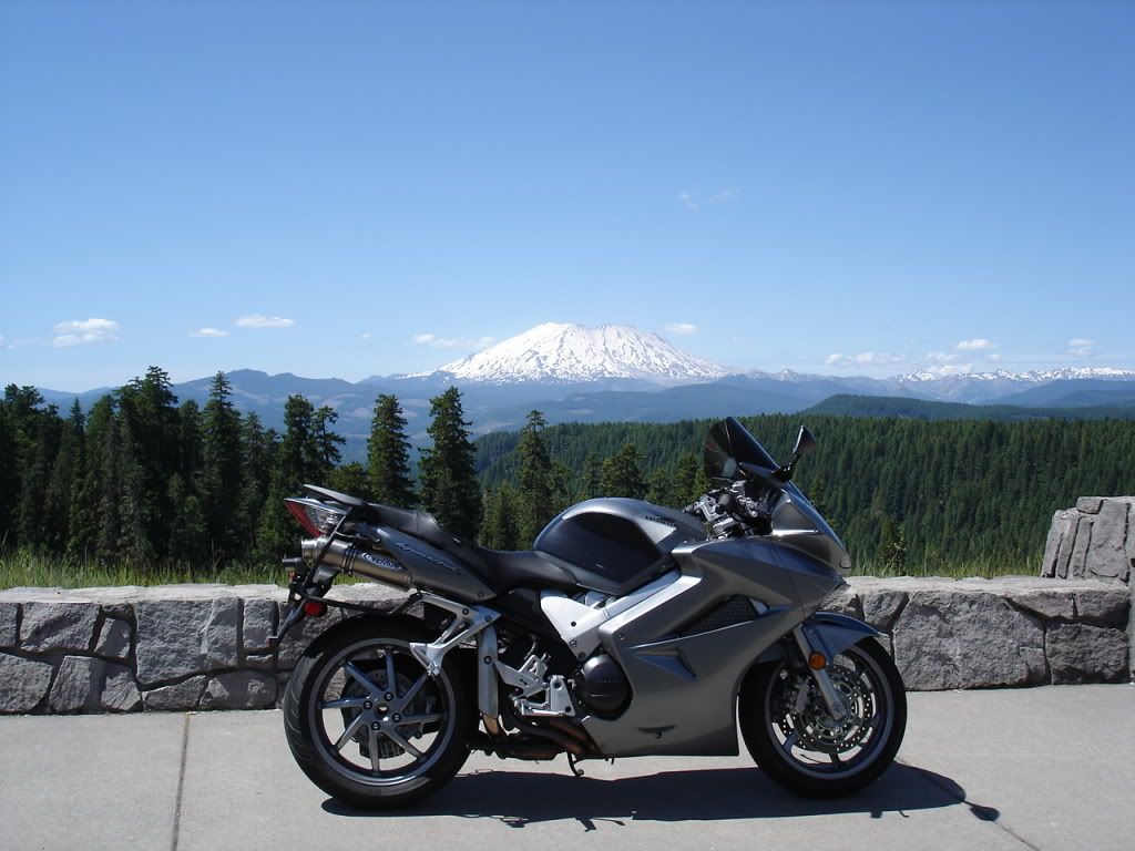
Just after the turn, about 2 miles down the road is a view point of Mt St Helens - spectacular view
Viewpoint
You'll continue down that road about 5 or so more miles where you'll come to a "T" intersection - take the left turn on Hwy 90 toward Cougar
Toward Cougar
Then when you get to Hwy 25 intersection, take a right. That puts you on the road north to Randle. I got this far last weekend, turned north and road about 10 miles north. Suddenly I encountered a locked gate - no explanation, just an iron bar across the road. I went back S on 25 to the ranger station and they said the road was still closed due to snow cover. I said to the park ranger "In July? :blink: " He replied that they've had one of the heaviest snowfalls on record and that that it would be a couple more weeks at a minimum before it would be opened. That would still be a week to go - but it sounds like that was the optimistic estimate. To be sure, I'd give it a couple of more. You'll get some great views of St Helens and there are some twisty roads that go back in closer to the mountain. You'll find gas at Randle, then you can decide if you want to go West to I-5 or East toward Yakima.
PM me if you have any more questions - I'll try to help all I can. Cheers